Showing posts with label Atlantic County. Show all posts

Wednesday, May 27, 2015

Shorebird migration: good news on Red Knots at Brig?

The lives of us Hidden New Jerseyans get complicated this time of year. There are always festivals, great events at historic sites and more opportunities for us to make friends within the conservation community. And spring migration gives us limited chances to see birds decked out in their finest plumage on their way to their mating territory. Even the birds that raise families in New Jersey get frustratingly hard to see as they settle down and build nests in trees whose branches have suddenly become so leafy they obscure anything within.

This larger-than-life representation of a Red Knot
memorializes Moonbird, who's been commuting
via the Delaware Bayshore for 20 years (and we hope still is!).
And then, there are the Red Knots. You might remember them from our story last year. They're the endangered shorebirds that make a pit stop on the Delaware Bayshore enroute from their winter homes in Argentina and Chile to their summer breeding grounds in Arctic Canada. The window to see them is pretty darned small: generally a few weeks or less in May and June, after the horseshoe crabs have come out of the water to lay their eggs on the shore. Knots take advantage of that ever-reliable cycle to fatten up before flying the final leg of their 9000+ mile journey.

Similarly, scientists flock to the Bayshore in large numbers this time of year to assess the health of the Red Knot population and its potential for growth. The fate of the species and the horseshoe crab are obviously intertwined, and efforts to bolster the crab population will have a major impact on these amazing travelers.

Given other obligations, we didn't have the luxury of journeying to the Bayshore on a May weekend, as much as we would have liked. And given that Memorial Day came so early this year, there was no way we were going to go as far south as the Cape May County peninsula. Instead, we took our chances with Forsythe NWR, a.k.a. Brig, figuring we'd be able to see at least some of the shorebirds we needed to bolster our year lists.

Still, I was hoping that a Red Knot or two would be in the mix. Considering how many warblers we'd missed seeing in New Jersey this spring, it seemed the fates owed us a treat.

As we started our drive along the eight-mile Wildlife Drive atop the impoundment berm, we noted that the tide was out, leaving broad expanses of mud between large islands of marsh grass. Normally conditions like that leave a lot to be desired; a bit more water would concentrate the birds into a smaller area of drier ground. As we scanned broad swaths of mud, we considered the possibility we'd have to do a second sweep a few hours later, once the tide had come in.

Still, though, we were finding occasional groups of shorebirds as we drove further along. Small Sandpipers and the occasional Willets gave us hope that we'd at least see something on our first go 'round.

Then we heard the ruckus. A pebbly expanse just past the grassy shoulder of the berm was alive with birds busily pecking in the dirt for their mid-morning meal. The noise was extreme as dozens of Ruddy Turnstones pecked and dug and, well, turned stones to search for their meal. A couple of sizeable horseshoe crab shells stood motionless nearby, sending the silent message that yes, in fact, there might just be some eggs there, fairly far from the oceanfront. This was a gathering well worth leaving the car to investigate.

Like bargain-seekers at the discount table, Turnstones pushed Sandpipers and their breed brethren aside to get a better angle on the possible horseshoe crab egg bonanza just below the surface. They were fun to watch, but both Ivan and I had the feeling a good surprise could be there for us, too. Scanning the group, I decided to get a bit closer to see if I could spy the birds that were so close to the berm they were obscured by grass. And, I saw... yes....

A Red Knot! Milling among the Turnstones, the sole bird of its kind plucked its way through the stones and sand for a good meal. While the Knot was a singleton, it looked rather healthy and plump, as if it might have been chowing down for a good couple of days. Forsythe isn't generally known as the place to go to see Red Knots, being on the Atlantic Coast rather than the Bayshore, but at least one decided to grace us with its presence.

As we later discovered when checking in with the Conserve Wildlife folks who keep track of such things, this year's count of migrants to the Delaware Bayshore has been especially good. That got me thinking about how our Red Knot found his way to a beach within viewing distance of Atlantic City. It's always possible that this single individual got a little confused or misplaced from the flock that usually ends up farther south and west, but I'd personally like to think that he's the harbinger, maybe the trendy guy who thinks he discovered the next great place for migrating Red Knots to spend their brief but meaningful Jersey Shore vacation.

Yes, I'll admit I'm anthropomorphizing, but we can always hope that these small but mighty shorebirds will become so abundant that they'll need to stretch out a bit when they visit here in future migrations. Would it be the worst thing for Red Knots to visit AC every once in a while?


Tuesday, June 10, 2014

Belco: (not) a blast from the past in the Pinelands

Acres and acres of pitch pines and other evergreens obscure the remnants of industry that once dotted the Pinelands. Land cleared for pig iron foundries and papermills in the 1800s has now been overtaken by regrowth, rendering the old factories difficult to locate. Other, more accessible abandoned industrial sites like the Estell Manor glassworks are easily visited within Atlantic County parks.

What we didn't realize on our original visit to Estell Manor was that there was a larger and more recently-built and abandoned factory community nearby. In fact, a good part of the park now stands on the grounds of the World War I era munitions manufacturing site and proving grounds known as Belco. Just outside of the former blast range, the companion factory town of Belcoville is still alive and well.

New Jersey's contributions to the war effort began well before the United States entered the conflict in April 1917, with several suppliers manufacturing ammunition for our allies. Once we were formally in the conflict, four additional factories were constructed around the state by various defense contractors, including the Bethlehem Loading Company, or Belco. Under the direction and supervision of the U.S. Army, Belco cleared about 10,000 acres of marshy pine forest along the Great Egg Harbor River to build the factory along with the nearby village of Belcoville to house more than 3000 workers and their families. An adjacent proving ground was to be the largest testing site of its kind in the world.

Storage facilities for loaded shells.
Courtesy Atlantic County Government.
War is a great motivator for rapid construction, and Belco is a case in point. Work on the factory site and village began simultaneously in early 1918, continuing non-stop, seven days a week. A subsidiary of the Bethlehem Steel Company, Belco was the only ordinance contractor to supply shells from mining the iron ore through forging the steel, machining, loading and assembling the final product. The site at Estell Manor was responsible for the loading and finishing stages, requiring both factories and complex safety measures to address the highly explosive elements that employees would handle.

The self-contained plant included everything that would be needed to keep production moving, including a power generator, water works, personnel offices, machine shop, blacksmith and carpentry areas, and storage facilities including reinforced powder magazines. A barracks held 1100 soldiers who guarded the plant against potential sabotage, a threat already felt from explosions at Jersey City's Black Tom Wharf and the Canadian Car and Foundry munitions plant in Kingsland.

Safety was paramount. Plants were built at distances to ensure that a fire or blast in one would not set off a chain reaction. A modern water pump and main system included special valves to ensure that firefighters would have adequate water pressure even if part of the system was damaged by explosion. Much of the plant was constructed of wood to prevent sparking that could set off fires, and escape chutes were built into the second floors of the plants, leading to protective ditches. Changing houses were built for both male and female workers to ensure that employees wouldn't track poisonous TNT residue out of the loading areas.

As a result of these measures, Belco was a reasonably safe place to work, and no fires or blasts of note caused significant worker injury or damage to the plant. No employee ever suffered from TNT poisoning though more than 17,000 such incidents occurred at other plants around the country. Nevertheless, a 100-bed hospital stood ready to address injuries and illness.

By July 1918 the first 155 millimeter shells were being filled and rolling off the assembly lines, even as construction work continued on additional factory buildings. Meanwhile, employees enjoyed the benefits of living in modern housing at nearby Belcoville, with running water and heating as well as community amenities like a school, bowling alley, shopping district and YMCA/YWCA.

Belcoville housing ranged from dorms for single employees
to large homes for supervisors with families.
Courtesy Atlantic County Government.
Just four months later, with about 70 percent of the plant built, the war ended, though Belco continued to turn out munitions for several months afterward. Plant buildings were dismantled and sold for scrap, leaving only the concrete foundations. Many of the newly-vacant worker houses were sold, taken down and moved to other locations in the area, while many employees remained in Belcoville to keep the community going.

Belco is listed on the New Jersey and National registers of Historic Places, and Ivan and I visited some of the roads and ruins recently, guided by an informative booklet available at the Estell Manor Park Nature Center. On a warm, sunny day, the gnats were in full force, accompanying us as we walked the broad main path into the complex.

Had we not already known that a busy manufacturing plant had been there less than 100 years ago, we'd never have been able to tell. Roadways are still evident from the long, reasonably straight breaks between trees, but many of the side streets are little more but wide strips of overgrown grass marked with wooden signs.

The booklet points out the sites of several Belco buildings which are a 10 or 15 minute stroll from the visitor center (depending on whether you stop to look for the stray cuckoo or vireo calling from the trees). We found the footings or a water tank and the machine shop, blacksmith and carpenter shop before the gnats got to be too much for us. There's more along the other paths, but from what I understand, most of it is along the lines of "you need an imagination to see it." No doubt, a late fall, winter or early spring visit might be more productive for those wanting to find more of the ruins.

Still, a hike through Belco is thought provoking. If such a busy industrial site can revert to virtual wilderness so quickly, what potential is there for other highly-developed tracts to be reclaimed by nature? So much of New Jersey has been paved over, some to great benefit and some not. Maybe sprawl isn't irreversible after all, and maybe old industrial sites can, with some effort, host wildlife once again.

Oh, and if our experience is any indication, it's a wonderfully reliable place to find Yellow-billed cuckoos. During our visit, we saw at least four, including a pair perched comfortably beside each other not far into the woods from the trail.


Thursday, August 15, 2013

When is a harbor not a harbor? When it's Egg Harbor City.

After a recent trip to Forsythe National Wildlife Refuge, we turned westward on county roads in the hopes of finding something interesting. We soon noticed a prevalence of street signs with German names: Bremen, Cologne, Frankfurt and more, plus Havana thrown in for some reason.

We'd stumbled upon Egg Harbor City, a harbor city that lacks a waterway. Not to be confused with Egg Harbor Township a few miles to the southeast, this community owes its existence to two signature mid-19th century trends: railroad expansion and nativism.

Chartered in 1852, the Camden and Atlantic Railroad had been built from Philadelphia to the coast to transport visitors to the planned resort destination of Atlantic City. The new railroad's board, however, realized that traffic on the new route would be highly seasonal, as there wasn't much else on the shore to attract city dwellers, or anyone else, for that matter. Between the terminal points of the railroad were wide expanses of sparsely-populated land that wouldn't yield passengers, either.

At the same time, German immigrants were facing mounting discrimination, personified by rapidly growing nativist organizations like the Know-Nothing Party. Subject to random and increasing violence in cities around the country, many sought places where they could live peacefully and live the American dream so many of them had traveled here to enjoy. They'd escaped tyranny in their home country only to find further oppression when they arrived here.

Several wealthy German-Americans were on the first train sent from Philadelphia to Atlantic City on the Camden and Atlantic, and the trip through virtually untouched woods and countryside must have inspired them. They soon formed the Gloucester Town and Farm Association to purchase almost 40,000 acres of the land they'd traveled across. First planning two cities, they eventually settled on building one community consisting of an urban core surrounded by farmland.

Marketing the new town nationwide but only through German language publications and agents within predominantly German communities, the Association sold shares which represented rights to 20 acres of farmland and a building lot within the designated downtown area. A widely distributed brochure promised "a new German home in America. A refuge for all German countrymen who want to combine and enjoy American freedom with German Gemutlichkeit, sociability and happiness." (Gemutlichkeit is one of those words that doesn't really translate well; it basically means contentment and cheerfulness.) When settlers arrived, they found what must have seemed like heaven on earth: a welcoming community where they could live and raise their families in peace.

That explains the German names, but what about the harbor? Present day maps of the city give you a pretty good idea of how the best laid plans can be diverted by reality. While the founders may have envisioned that burgeoning industry would prompt the city to grow more densely outward toward its border against the Mullica River, the land between downtown and the anticipated harbor was better suited for other uses. John C. Wild soon discovered that the soil was ideal for growing grapes, attracting a host of other Germans, Italians and French immigrants experienced in wine making. In 1864, Egg Harbor City became home to Renault Winery, ushering New Jersey into a new industry which persists today. It doesn't seem likely that the bustling harbor will ever be built.


Thursday, July 18, 2013

Scratching my head on Mankiller Bay

Every once in a while, I have to throw my hands up and admit to being stumped.

As you've seen, Hidden New Jersey is dedicated to shining light on lesser known (and often lesser noticed) aspects of history, culture and nature around the state. Much of the time, we've noticed these things in our travels, and sometimes I've got to do some reading or rooting around to get to the hidden story. Even when we talk about better known people and places, it's with an eye toward sharing an aspect you might not have known.

Then there are the things that even we can't explain.

Mankiller Bay seems to be one of them. Just northwest of Atlantic City, it joins Absecon Bay with the Inlet of the same name. It even has a namesake spit of land within it, the uninhabited and likely very marshy Mankiller Island.

This is one I've admittedly been hanging onto for a while. I jotted it in my notebook during a road trip, likely enroute to Brigantine Island to look for wintering shorebirds. But try as I might, I haven't been able to discover why these Mankillers deserve such an ominous name. Old sporting guides state that the island is good for hunting, and a bunch of fishing resources cite the bay's finned bounty, but its history? It eludes me.

Any ideas, folks?


Wednesday, May 29, 2013

Confronted by the Jersey Devil at Leeds Point

Following a moderately successful birding day on the trails at Forsythe National Wildlife Refuge this past weekend, we decided to check out some of the nearby side roads. Most people who visit Brig only go to the main portion where the visitor center and wildlife drive are... and that's fine. We wanted to see a little more.

Gotta love a healthy wetlands.
Leeds Point Road forks off of Route 9 north of Smithville and leads to other parts of the refuge, including the Scott's Landing Boat Launch. The focus there changes from wildlife viewing to duck hunting, and a rather ingenious Eagle Scout project uses a series of signs that look like birds to illustrate the permitted shooting range. Given that we're well out of hunting season, we could enjoy the sights of healthy spartina waving in the breeze without being concerned with random shots.

Binoculars always in hand, Ivan wanted to explore the stand of trees near the parking area, so in we went. We quickly felt enveloped by pitch pines, reminding us that we were, after all, in the outer reaches of the Pinelands. While blotches of sunlight shone down through hurricane-created holes in the canopy, the gnarled trees made the place feel unnatural and weird. I couldn't wait to get out.

I really don't like to make generalizations or contribute to shaggy dog stories, but we were in Leeds Point, which added a slightly mysterious undertone to the small forest. Not far from the waters of the Atlantic, the hamlet may or may not be the legendary birthplace of the Jersey Devil. Depending on which source you consult, he might have been born farther inland at Estellville, or perhaps amid a swamp along the Mullica River, which, come to think of it, is pretty much where Leeds Point is. The horned-and-winged one never seemed like much of a Shore guy, though there's a tavern called JD's in Smithville that serves a very tasty Jersey Devil burger.

Satisfied that the stand of trees wasn't very birdy at the time, we found our way back inland and turned right onto Oyster Creek Road. Just a few yards down from the intersection, we came upon this sign:

Jersey Devil sign Hidden NJ Leeds Point

Well, gee. We didn't know whether to be amused or concerned: amused for the obvious reason, concerned that we might not be welcome visitors, no matter our innocent intent. Were the locals fed up with rowdy explorers looking to raise the devil? Or were they pranking their neighbors on the next road? If they truly had negative intent, it's not likely someone would have put so much effort into an artistically-rendered three-dimensional sign. Instead, they'd have just spraypainted "Get out!" on a plank of plywood and nailed it haphazardly to a tree.

We continued driving down the road, next coming upon a creatively-executed sign advising motorists to watch for and respect motorcycle riders. Fair enough. Bikers would have enough of a challenge with the road, given the uneven, pockmarked macadam.

What we found at the end of the road was a mix of weatherbeaten Down Jersey fishing shacks and small bungalows that weren't quite as worn. Folks may live in one or two of them, but for the most part they look like shelters for weekenders who want to get a few hours sleep before jumping in their outboard-powered rowboats in the predawn hours. All they really need is space for a couple of air mattresses, indoor plumbing and a fridge for bait and beer.

Next to what looked like an old boat yard was the Oyster Creek Inn, which had attracted a sizable holiday weekend crowd. I could have sworn I'd found this place once on my own, during the depths of winter, but it was a lot livelier on a sunny spring weekend. The marsh, just north of the tract we'd seen at Scott's Landing, looked fresh and healthy. If the Jersey Devil had been born here, he'd be hard pressed to be evil. That is, until the greenheads come out in the humid languor of July.

Wednesday, May 1, 2013

The Battle of Chestnut Neck: Atlantic County's Revolutionary War saga

I've got a warm spot in my heart for communities that make an effort to commemorate their otherwise little-known places in history. Having grown up in Union, I'll explain the significance of the 1780 Battle of Connecticut Farms for anyone who will stand still for five minutes. Thus, I was in my element when Ivan and I stopped to check out the imposingly tall monument on Route 9 north of Forsythe NWR.

Bordered by roads on all three sides, the monument seems vaguely off. First, it seems to be in the middle of nowhere, though it's a short drive from the Parkway. Second, the statue of the Revolutionary War-era soldier on top is facing out to sea. It's definitely not placed to attract a ton of visitors, but as we discovered, there's good reason.

We'd stumbled onto the site of the only Revolutionary War battle to take place on the South Jersey shoreline. Memorializing the 1778 Battle of Chestnut Neck, the monument was erected by the Daughters of the American Revolution a little over a century ago. After we parked the car, we discovered even more: a British anchor and a smaller memorial, plus a very informative set of postings from the local Sons of the American Revolution.

To understand the strategic importance of Chestnut Neck, you need to know a little about the naval resources of the Continental forces during the battle for independence. Plainly put, they weren't much. Conversely, the British Navy was considered to be the finest in the world at the time. To improve the odds, the Continental Congress enacted a privateer system by which private merchant vessels were commissioned to capture British supply ships, bring them to port and unload their cargo. Not only would the British fighting forces lose valuable supplies, but the cargo would be sold and proceeds split among the American captains, crew and government. You could say the British were hoisted by their own petard: they'd successfully used the same strategy against the French in an earlier dispute.

A map near the monument
illustrates the terrain and location
of the Chestnut Neck fort.
In Southern New Jersey, the Great and Little Egg Harbor Rivers played crucial roles in this new economy, hosting warehouses and markets for the plundered British cargo. Chestnut Neck stood at the mouth of the Little Egg, and residents built a protective fort in 1777, funded by the New Jersey Assembly. It appears, however, that the budget never accounted for guns. Regardless, the port prospered as a privateer base, hosting the sale of about 30 ships and their cargo.

That kind of success naturally made Chestnut Neck a target of British ire. From their base in New York, General Clinton and Admiral Gambiel determined that the privateers and their cohorts had to be stopped. Nearby Batsto Ironworks was accessible by the Great Egg Harbor River and deemed a worthy target while they were in the area; ending production there would severely hamper the Continentals' weapons supply.

After departing Manhattan on September 30, 1778, the British ships' arrival was pushed back due to harsh weather, giving the Americans a chance to learn about the plot and move many of their ships safety at sea or farther up the river. Nonetheless, when the British reached Chestnut Neck on October 5, local loyalists updated them on militia plans and activities.

This more recent monument
honors privateer captains.
The next day saw the bulk of the action. While the British fleet had difficulty navigating through the shallow waters of Little Egg Harbor River, they managed to make it to Chestnut Neck, which was largely undefended. The remaining ten ships under colonist control were dismantled and burned, along with the fort and the rest of the community. According to contemporary reports, the fires persisted well into the next day.

While the British may have destroyed Chestnut Neck, they thought better of continuing on to Batsto to complete their mission. The fact that many of their craft were becoming grounded in the shallows, combined with the knowledge that the Americans were on to their plans, was enough to encourage them to withdraw.

Still, the British raid had permanently wiped Chestnut Neck off the map as an organized community. Residents resettled at nearby Port Republic, though there's now a relatively small area with a few houses and several boat ramps for small craft. And, of course, there's the monument. If you're in the area, just take Parkway exit 48 to Route 9 south and keep an eye toward the East. You'll find it pretty quickly.


Tuesday, March 12, 2013

Trotting along the White Horse Pike

Where in heck did the White Horse Pike get its name? Not being a South Jerseyan, I've long wondered why that particular nomenclature stuck to a road that runs east/west from Atlantic City to the Ben Franklin Bridge in Camden. As far as I knew, the area wasn't home to a herd of albino horses, and the equine population is Camden County isn't particularly high.

Perhaps there was a racetrack nearby?

Maybe a European settler had ridden a white horse down the road in the early days of West Jersey?

Or maybe it's a ghost horse, the Camden County equivalent of the Jersey Devil?

The answer, as I discovered, came from much farther back than the opening of the Garden State Park Racetrack in Cherry Hill (which was on another road, altogether). Chartered as a toll road in 1854, the White Horse Pike originally ran about 14 miles from Camden to the village of White Horse, which had taken the name of the tavern at its center. The White Horse Inn had been built in 1740 along a footpath the Lenapes had reportedly used as their road between the Delaware River and the Atlantic Ocean. It's been theorized that the inn's owner, Elizabeth Bates, named her establishment for the natives' horses.

I drove part of the Pike after my visit to Lawnside, prompted by the WPA Guide to New Jersey. The guide claimed the Inn was operated by the same family for nearly 200 years, with the original sign, complete with a picture of a white horse, still hanging from the porch. Granted, I was counting on a 70 year old description of the place, and lots of things can happen in that stretch of time, but I was cautiously hopeful the inn would still be there. It had, after all, been an important stop on the stagecoach route and the stimulus for the growth of the village. Maybe it wasn't in a county seat, as Mount Holly's Mill Street Hotel and Tavern is, but it sounded as if the White Horse was equally worthy of preservation.

Scanning the roadside at highway speed can be daunting, even when you have to stop occasionally for traffic lights. I saw a muffler man hawking tires in Clementon, but beyond that, it was the usual assortment of chain drug stores, fast food joints and assorted mom-and-pop emporia. Some of those looked pretty old, but nowhere near colonial-era old.

The Quaker Store in Stratford. Nice porch!
Then I saw what I thought could have been the White Horse Inn, sitting at a triangular-shaped plot of land formed by the intersection of Route 30 and Berlin Road. The building looked old enough but had signs stating "Friendly Quaker Store." As I later found out, it's the oldest surviving building in town, having been built in the 1860's on the foundation of the 1740's-era general store. Local preservationists have been working to restore it, and long-time Stratford residents still remember the proprietress and her kindness toward those who needed a little credit until payday.

Still, though: if the Quaker Store was the longest-standing building in the community, that meant the White Horse Inn wasn't to be found. Indeed, later research revealed that it was torn down in the 1970s to make room for a strip mall, likely the one where I stopped to take the photo above.

White Horse Farm Hammonton NJ Hidden NJ
The White Horse, in Hammonton
Disappointed not to find the White Horse, I kept driving toward Atlantic City, toward Hammonton. Development along the roadside got progressively less commercial and increasingly more rural, with farm fields replacing retail buildings. I'd stopped to grab a sandwich earlier, but I didn't pull into one of the rare parking lots to eat it; there were so few cars in the restaurant lots that I felt it would be rude to take up a spot for a repast I hadn't bought there.

The road had gotten really quiet by the time I drove reached the town limits of Hammonton, the self-proclaimed Blueberry Capital of the World. Traffic undoubtedly picks up substantially during growing season, but in early March there wasn't much going on. When I pulled into the lot of the quiet White Horse Farms to take a photo, I saw a red-tailed hawk dive toward the center stripe of the road and swoop up to perch on the adjacent roadside utility line. Something tells me he does that a lot, without consequence.

At least I found the White Horse, even if it wasn't the one I expected to see. And I discovered quite a few targets for pick-your-own during blueberry season. Elizabeth White would be quite satisfied.


Monday, November 26, 2012

Back to the Brig: life continues at Forsythe after Sandy

It had been a good long time since Ivan and I had been to Forsythe National Wildlife Refuge, a.k.a. Brig. Looking back at my birding notes, our last visit was in August, when we went to see the ever amusing, rare to New Jersey reddish egret. We've had a good year at that location, with plenty of new life birds for me and a reportable sighting of two black-bellied whistling ducks for Ivan. Even without a big-name spotting, a couple of hours at Brig always leaves me with a warm feeling about the future for our regional wildlife. There's definitely a home for threatened and endangered species to nurture and raise their young.

A three month gap between visits doesn't seem like a lot, unless you consider that for a couple of weeks in that time, we couldn't have gone there if we'd wanted to. You see, Hurricane Sandy was as unkind to Brig as it was to most of the other Federal lands in the New Jersey area. Storm surges severely damaged the refuge's Wildlife Drive, pushing salt water to breach berms separating the Atlantic from freshwater pools, and strewing detritus around some of the more ecologically-sensitive areas. We were saddened to hear about the storm's impact on one of our favorite birding spots and hoped the problems could be resolved before the ecosystem suffered any further negative impact. Had the birds been so disturbed, had their habitat been so affected that they'd avoid the place for a while?

It was a question that was answered in less time than we thought. About ten days after the storm, Refuge staff reported on Facebook that the numbers of birds were continuing to increase day by day. Then on November 16, the U.S. Fish and Wildlife Service reopened portions of Brig. The visitor center and walking trails are accessible, and portions of the land-based roadways are open to foot traffic, but the Wildlife Drive through the impoundment pools remains closed until repairs can be completed.

Obviously, we had to check it out. We knew that the inaccessibility of the impoundments meant we'd see fewer water birds close-up, but the Refuge's pines might yield the winter finches that have been eluding us. And yes, we had to see Sandy's impact for ourselves, if possible.

When we got to the parking lot yesterday, we found the place to be unusually quiet for a Sunday morning. Only one other car was in the lot, and since the drives were closed, we knew we had to be just about the only visitors to the property.

Undeterred, we started exploring the wooded areas nearest the lot. A quick check of the kids' area behind the restrooms revealed a wealth of species, including towhee, golden crowned kinglet and Carolina wren as well as your general winter yardbirds like cardinal, Carolina chickadee and white-breasted nuthatch. The pine grove near the administration building didn't yield any crossbills or grosbeaks, but the area looked fine, little changed by the storm.

The visitor center was open by the time we were about to walk past to go to the gull pond, so we stopped in. Staff members there corroborated what I'd been thinking: maybe the relative quiet of a human-light environment would encourage birds to get a bit braver about roaming closer to the public areas. One woman even mentioned she'd seen a larger number of harriers scanning the area than she had in quite a while. It seemed that if we weren't going to be able to see the hundreds of ducks and geese normally on the impoundment pools, we'd still find a good range of late fall and winter species on the property.

The gull pond is usually a reasonably short drive via a hard-packed sand road. Now open only to foot traffic, it offers a good view of a couple of expanses of water that often produce a variety of egrets, ducks, gulls and shorebirds. This time was no exception, including a large group of killdeer whose distinctive vocalizations announced their arrival. True to form, harriers were scanning the marsh grass, and we spied two adult bald eagles in the distance, apparently enjoying a nice flight together.

It was those eagles who gave me a real show later on. As Ivan and I were walking the Leeds trail on the other side of the visitable refuge area, I noticed the two raptors high up in the distance, performing a sky ballet together. They'd fly near each other, briefly part, and then soar almost in synch, one ahead of the other. A few times, one would fly almost upside-down beneath the other in what looked like a show-off stunt. I've seen birds hassle each other, but this was clearly not what these two were doing. Perhaps they were... flirting? Were they a mated pair?

I watched bare-eyed as they danced, enjoying the performance that apparently Ivan and I were the only humans present to see. Then, improbably, I saw one fly upside-down under the other, locking talons to perform the classic eagle maneuver of tumbling together toward the ground below. Was I witnessing a true mating ritual? "Omigod, omigod omigod..." I exclaimed, trying to get Ivan's attention as I brought the binoculars up to my eyes. And then they disengaged after a few tumbles, righted themselves and flew onward, out of view.

That experience brought me farther along the bald eagle circle of life that's been forming for me during visits to Brig. On my initial trip there last year, Ivan pointed out an immature eating its prey on an ice-covered impoundment pool. Since then I've seen enough juveniles and adults to realize that the refuge isn't just a stop-over for bald eagles; it's a place they count on for sustenance. And maybe now my dancing friends are preparing to raise a family there, if they haven't been doing that already.

Maybe there's still a lot of work to be done to bring the refuge back to its pre-storm state, and maybe only part of the property is open for visitation, but there's still a lot of life there, and tons to observe. You should get out there, and let us know what you discover for yourself!


Wednesday, September 12, 2012

Smithville and the wreck of the Powhatan

No matter where we're going, if we come upon an old graveyard, there's a good chance we're stopping. Ivan's always on the lookout for Civil War veterans, and I'm just interested in a good story or interesting memorials.

That's why it's so odd that we only recently stopped at the Emmaus United Methodist Church in Smithville. We pass by every time we take Route 9 to Brig, and some of the stones are so close to the road we can read them if the traffic light at the corner is red. On our last trip, we noticed what I think was a new sign, noting the burial site of 54 German immigrants who'd died in the wreck of the Powhatan in April 1854.

We stopped to check out the graves but found no other indication of names or exact interment sites for the 54. If the large brown sign hadn't been erected, the average visitor would have no idea that the ground was the final resting place for nearly five dozen people whom fate denied a future in the United States. Smithville is fairly close to the ocean, but not so much that you'd think a ship was wrecked there, so why were the victims buried in this cemetery?

To get our answers, we travel more than 150 years back to a time when the Atlantic coast near Long Beach Island was considered the shipwreck capital of the world. Barnegat and Absecon Lighthouses were yet to be built, and dangerous shoals in the area regularly took seafaring victims, especially during storms. The packet ship Powhatan was sailing to New York from LeHavre, France with a few hundred passengers on board when a Nor'easter blew in. The ship went aground at Beach Haven and split in half, and all souls died.

Recovering the bodies of the deceased was arduous work, made more difficult by the terrain. While some were immediately found and buried near the wreck site, others floated farther west into inlets, bays and creeks. Two Smithville men recovered the 54 Germans and brought them back for burial in the community's graveyard. Though the deceased ultimately were placed into a mass grave, the locals provided as much dignity as they could. While the men constructed coffins for each of the dead, the community's women made burial garments for each. Other Powhatan victims were buried in Absecon as well as in Manahawkin, where they're now memorialized.

While it's a sad tale made even sadder by the thought of the lost potential these immigrants had in the United States, their lives were not lost in vain. The Powhatan wreck is said to have been the impetus for the construction of the Absecon Lighthouse, which still stands in Atlantic City as one of the tallest beacons in the nation. Between that light and Barnegat, the treacherous New Jersey coast became much more navigable for mariners.


Sunday, August 26, 2012

Unfazed by Shark Week? Give Heron Week a try.

Discovery Channel has Shark Week.

Hidden New Jersey had Heron Week.

Okay, it doesn't have the same menacing bite or blood-curdling suspense, and we didn't need to protect ourselves with a cage, but our bird week had the element of surprise and even a fun new dance step.

tricolor heron dekorte park new jersey
This tricolor heron has been hanging around
the Meadowlands for a couple of weeks. 
Followers of our Facebook page already know about our first three episodes. I'm going to cheat a little and start on August 15, when I got a view of the tricolor heron that's been hanging around DeKorte Park in Lyndhurst. Reasonably rare for New Jersey, he was hanging out among some terns, perched in the open on a railing along the Marsh Discovery Trail. (Many thanks to the Meadowlands Commission's Jim Wright for setting me on course!)

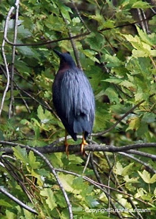
Last Wednesday, I had a three-heron day at Echo Lake Park in Mountainside. The lower lake segment yielded a not-unexpected great blue heron along with a curfew-busting black-crowned night heron. The nice surprise for me there was the presence of not one, but two green herons. While they're not tremendously rare, they're not exactly an everyday occurrence, and I was glad to have found and identified them on my own.

Green Heron Lenape Park New Jersey
Green herons really seem to like
Union County parks in August.
The next day I returned to Echo Lake with my camera, hoping to get a shot of the green heron, but he'd already moved on. Just as well, as I located one (maybe even the same guy) at adjacent Lenape Park in Cranford. A subsequent trip to Surprise Lake in Watchung Reservation yielded yet another greenie, not far from another great blue.

Later that afternoon, a check of the American Bird Association bulletin boards revealed big news: a reddish egret was spotted at one of our regular birding destinations, Forsythe NWR (a.k.a. Brig). This was significant. I'd never seen one, and the range map in the Sibley guide showed it as a rare visitor to the Eastern Seaboard. Just as important, the guide described the bird as "very active, chasing fish on foot, running, jumping and spinning." This I had to see: the Bird Minister of Silly Walks. Check out this video for a sample, and tell me you wouldn't want to check it out, too. There's something very appealing about watching a bird that looks like a drunken frat boy hunting for his lost keys.

Ivan and I decided that waiting for the weekend was not an option. If reports in the morning said that the bird was still at the refuge, we were making the trip to see it. All egrets, of course, are herons, so a chase for the reddish egret would fit perfectly into our theme week.

Friday morning dawned, bringing with it news of the bird still in its reported area at Brig. After getting some non-birding activities out of the way, we hopped on the Parkway, hoping the shore traffic hadn't started yet. We ran into some frustrating construction delays but told each other that if fate deemed the bird would leave before we got to him, we'd accept it.

Once we got to the refuge, we blew off the usual first stops and went directly to the eight-mile loop road through the marsh. Thursday's reports had the bird at the dogleg turn about three-quarters down the road, but a crowd of cars and birders were clustered about a mile or two into the drive. If this wasn't the egret, it was definitely something worth seeing.

Ivan pulled up to a couple of the gathered birders and rolled down the window to ask if it was the reddish egret. Yup.

"I thought it was at the dogleg."

The other birder shrugged. "It has wings."

Our quarry was roosted in a distant cedar tree, along with a couple of snowy egrets. Apparently he'd already eaten, because he seemed more interested in preening than in jumping down and doing the runaround dance. Or perhaps we'd just timed it badly and had to wait for the next show. In any case, his staying put allowed us to get a good view through the scope, enough of a study to feel that we could add the reddish egret to our New Jersey birding lists. And besides, though the bird didn't seem to want lunch, we humans were famished. We'd head over to JD's for a burger and return to see what else Brig had to offer us that day.

Our hunger eliminated, we returned to the refuge, this time making our usual stops before embarking on the loop road. A stop near the gull pond produced a view of easily a dozen great egrets perched in a tree, along with assorted others wading about. In the time since we'd left, however, the tide had rolled in, displacing many of the shorebirds that had been walking around the mudflats on our earlier visit. Maybe this wouldn't be such a productive visit, after all.

A new set of birders were perched and focused at the same spot in the road as we'd been with the earlier crowd, and for good reason. Perhaps encouraged by a higher water level, the reddish egret had come down from his perch to forage for fish. We stopped again, pulled out the viewing scope and were rewarded with the sight of him pacing around the shallows. Apparently a juvenile, he didn't seem to have the silly walk down pat, but he was entertaining to watch, nonetheless. Seeing that performance, I was satisfied to have gotten a good view of a creature I might never be in the presence of again, at least not in the Garden State.

That would have been a great ending to Heron Week, but our luck continued the following day when we visited Salem County. Driving through the countryside enroute to Hancock's Bridge, we passed the inevitable cattle and... the accompanying cattle egrets. Ten of them were patrolling the pasture, some close to the cattle and others a little on their own. Not as improbable to New Jersey as the reddish egret, it was still a nice find for us.

Heron Week aside, we've been very fortunate to see some rare and wonderful avian visitors to New Jersey over the past year. Whether it's due to global warming or just an odd coincidence for them to find their way here, I'm grateful that places exist for them to rest, find food and seek refuge. Who knows what's in store for next year's Heron Week?


Sunday, July 15, 2012

Everything but a partridge in a pear tree: a banner day at Brig

You know it's going to be a good birding day when you spot two bald eagles on a transmission pole on the side of the Garden State Parkway at 7 a.m.

July is not the best month to go birding. As I mentioned when describing our Glassboro jaunt, it's both humid and fraught with the perils of greenhead flies, neither of which rank among my top ten reasons to spend time in the great outdoors. Still, though, it seemed as if Forsythe NWR, a.k.a. Brig, was our destination for the day. It was easily the most significant birding hotspot listed on the state rare bird alert issued just before the weekend.

Ivan and I left Hidden NJ headquarters at o'dark thirty and were at the Galloway Wawa by 7:15, having seen the aforementioned eagles just north of exit 48. The target bird for the day was the white-faced ibis, which had been reported to be at Brig a few days before, plus whatever interesting shorebirds made their appearance.

It didn't take long for us to find something interesting. Several glossy ibis were around, allowing me to say, "Ibis in the morning" like an adenoidal morning radio host. Then, however, Ivan spotted a common moorhen nearby, an unexpected bonus and a life bird for me. As I watched, it neared the birds we'd already called. "Nice!" I observed, "it's in the same field of vision with the ibis!"

"Ibis and the moorhen," Ivan observed, to the tune of the same morning radio show. Obviously it was going to be a bad pun day.

The route around the impoundment marshes gave us a nice selection of shorebirds, plus a bonus snow goose that must have missed the memo to head northward for the summer with the rest of his flock. He seemed to be trying to ingratiate himself with the larger Canada geese who apparently wanted little to do with him.

The birds on the water scattered en masse at a point, a sure sign of a predator overhead. We watched as a bald eagle, our third for the day, circled overhead and then landed in the shallow water to fish. With his ample dark leg feathers showing clearly through the viewing scope, he looked like an old man in waders, poking around.

Further marsh views brought us yellowlegs, assorted terns and a bonus blue grosbeak, but the real treat awaited us a little farther inland. The one-way driving route brings visitors past the interestingly-named Experimental Pool, a term that always puts me in the mind of three-eyed fish but describes, in fact, a very nice little marshy pool. We never seem to see anything there -- even typical stuff -- but we always make the stop, just in case.

Viewed from the observation deck, the near side of the pool was loaded with aquatic greenery, mostly blooming lilypads. One particular clump appeared to have some brown leaves stuck in the middle, but Ivan noticed some movement. Is that a....

"Black-bellied whistling duck!" he exclaimed. I trained my binoculars on it as he ran back to grab his scope for a closer look, and suddenly the brown leaf next to the duck gained a neck and a head just like the other. It wasn't a single rare sighting, but two -- a pair of black-bellied whistling ducks! These folks have ventured far away from their usual breeding homes in Texas. A pair had been sighted near the Cape May lighthouse in 2011, but we were apparently the first birders to see the species in New Jersey this year.

Quickly returning and setting up the scope, Ivan got a closer focus on the birds and confirmed it. The chestnut colored back, whitish wing stripe, black underside and red bill unquestionably qualified them as black-bellied whistling ducks. We definitely needed to let the birding community know, but photographic evidence would make the sighting that much more certain for others. Just our luck, I hadn't brought my good camera; all we had available to us was my smartphone. Perhaps if we aimed it through the scope, we'd get something good.

Well... what can I say? Given that it's a new phone, I'm still learning to use it, and the lens placement made it a bit challenging to aim through the scope's viewfinder. Added to that, the ducks were playing hide-and-seek with us by swimming behind the marsh grass. What we ended up with was a shot that could be compared unfavorably with some of the worst Loch Ness Monster shots to be published in the Weekly World News. (There's a much better representation of the species here.) Judge for yourself:
See those brownish shapes toward the middle of the photo?
Those are the black-bellied whistling ducks.
Fortunately we found the nearby Atlantic County library via GPS so Ivan could use their computer to report the sighting online quickly. Other birders then heard about our find in sufficient time to visit the Experimental Pool and make the sighting for themselves before the birds left the location. (In fact, an intrepid Hidden New Jersey reader reported seeing them just a few hours after we did.) Since then, the ducks have been sighted elsewhere in the refuge, and better photos than mine have been taken for documentation purposes. Needless to say, I'll be bringing my camera the next time we go to Brig!


Friday, May 25, 2012

The Jersey Devil and the Pot House: glassmaking at Estellville

Fresh from our find at Weymouth, Ivan and I headed a slight bit eastward on the Black Horse Pike. I'd heard about another ancient Pinelands factory nestled within an Atlantic County park. We were so close by, we had some time before we were expected elsewhere, why not go for it?

The former Estellville glassworks operated from 1825 to 1877 and was reportedly among the first to produce both window glass and bottles. About three and a half miles south of Mays Landing proper, it's now surrounded by an expansive parkland of playgrounds, picnic areas and untouched woods. The factory site itself is about halfway along the circular park road, well marked out with wayside signs. Though the buildings have deteriorated to about the same level of falling-apartness as the site we'd just visited, helpful numbered maps direct visitors to various features of importance in glassmaking.

Like the Weymouth Furnace, the glassworks was made up of several buildings, but in this case, each represented a stage of the manufacturing process. We first went to the pot house where workers made the vessels in which sand, potash and limestone would be mixed and melted to make glass. According to the wayside, replacement pots were needed often, as they'd become damaged by the high heat of the melting process.

Several steps away, a three-room building once held the furnace where the raw glass was made. It was also where glassblowers would shape the molten material into cylinders that would be flattened in another building and eventually cut into windowpanes. Here's the wild thing: the blowers would often strap themselves to the wall as a counterbalance against the 80 pounds or so of molten glass they'd pick up from the vat with their blowpipes. Those who chose not to take the safety step might -- and sometimes did -- find themselves falling into the pit to meet an unfortunate and painful end.  

Between the furnace building and the flattening building, I noticed several small objects glistening in the sun. They turned out to be weathered pieces of glass, possibly from the factory itself, as none of it seemed thick enough to have been broken bottle shards from a more recent visitor.

The park signs and online guide led me to believe that foundations of workers' houses could be found in the far reaches of the tract, so Ivan and I followed a path into the nearby woods. As we walked, I remembered something I'd read in the handy WPA Guide to New Jersey, which only mentioned the glass factory as a side note. The writers were more interested in highlighting Estellville as the birthplace of the Leeds Devil, more commonly known these days as the Jersey Devil.

Before we go much further, I want to make a statement: we here at Hidden NJ try to avoid the usual Jersey legends and apocryphal stories in favor of the more obscure yet plausible. I'm rather proud that we've published for nearly a year and a half without making hay of Mother Leeds' thirteenth child, but when you stumble upon the purported birthplace of the ol' JD, you have to say something. Plus, he's got wings, so I figured I could include him as a birding feature.

I mulled the possibilities as we walked farther down the path than my research had indicated the workers' homes would have been. The path was well maintained and lined in places by flowering bushes, but who knew if we were walking into territory where a cloven-hooved flying beast would rather be to himself? Focused on finding some of the birds whose songs he'd been hearing, Ivan ignored my suggestions that maybe I'd misread the map and we should instead be looking for the buildings elsewhere.

We decided to turn around after we reached a small deck overlooking a creek and pilings that once apparently supported a bridge. Walking back to the glassworks, we did find an elusive flying creature, but it turned out to be a yellow billed cuckoo rather than ol' JD.

Given the park's size and diversity of habitat, we'll likely be headed back to Estellville sometime soon for birding at a more productive time of day. I guess that means we'll also have another chance to check in on the state's scariest and most active citizen, the immortal Mr. Leeds.

Tuesday, May 22, 2012

Industry among the ruins in Weymouth

Of all the times we've visited Forsythe NWR, Ivan and I had yet to venture west of Route 9 in Atlantic County. This past weekend we headed inland on the Black Horse Pike to check out a couple of old factories we'd heard about.

These weren't factories in the 20th or 21st century tradition ... they were OLD, befitting the development (or lack thereof) of the Pinelands. What many people don't realize is that while there's very little industry there now, the area was a hotbed of production in the early days of the United States.

Great Egg Harbor River Weymouth
There's iron in that water!
Our travels took us less than a mile off the Black Horse, on County Road 559 to a smallish park along the Great Egg Harbor River. Well populated on a flawless May afternoon, the site has plenty of older trees to shade the grassy areas, along with the ruins of several old brick structures. A gentle though brisk current brought a few parties of canoers through, but something else about the river caught my attention. While the water was as clear as you'd expect in the Pinelands, the sunlight exposed redness on the river bed. That rust color explains just why the old brick structures are at Weymouth: the presence of iron.

We've talked a lot about the iron mines of the northern reaches of the state, but very little about the south, where bog iron once drove significant industry in the Pinelands. A partnership of five men got state permission in 1801 to dam the Great Egg Harbor River as a power source for an iron works at Weymouth, and within 50 years, the site was host to one of the region's largest communities. Besides a charcoal-fired furnace and forge, industry on the 85,000 acre site included a gristmill, sawmill, blacksmith and wheelwright. A store and Methodist church were also built, along with housing for workers and a large mansion for the forge's owner.

Weymouth Iron Furnace New JerseyFor most of its operating history, the iron forge produced mundane items like nails, pipes, stoves and cooking pots, but it contributed to the nation's defense, too. Weymouth supplied shot and bombs to the army for the War of 1812, though it seems not to have done the same during the Civil War. With the development of the coal industry, Pennsylvania forges could produce better quality iron products, essentially leaving New Jersey in the dust.

Iron processing may have ceased to be an option at that point, but the river continued to power industry at the site. The Atlantic Paper Mill and Weymouth Paper Mill recycled rags, bagging and manila rope to produce paper until wood pulp became more prevalent as the main ingredient for paper products. By 1898, the mills were silent, rendered obsolete by progress.

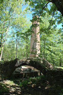
The property lay unused, buildings decaying and vandalized, until 1966, when the Atlantic County government started buying up the property for inclusion in the park system. Some of the ruins have been fenced in for protection, but you can still reach some of the stabler structures, including the arches that span the largely dry millraces. A cast-brick chimney also stands in stark contrast to the stone foundations of the furnace it once served.

Given the impulses that unfortunately drive some people to destroy history, I have to say it makes sense to surround the Weymouth ruins with a park. Visitors are exposed to a fascinating aspect of South Jersey history as they picnic and canoe through the property, and hopefully that encourages them to learn more. Having people around also tends to deter vandals from acting out.

One resident in particular seemed to be taking extra effort to guard the fenced-in ruins while we were there. Ivan noticed a female Louisiana waterthrush sitting on a branch just above the enclosure, wagging her tail from side to side as if conducting an orchestra. She patiently waited for us to leave, no doubt because she wanted to distract us from her nest. Regardless, it was a nice little surprise, considering we didn't expect much avian activity during the middle of the day.

Saturday, March 10, 2012

Crossing the Black Cat's path in Absecon

If you grew up near a highway in New Jersey any time before the early 1980s, you probably remember at least one piece of interesting roadside architecture. My formative years were spent in Union, so I got an eyeful of Route 22 wonders like the Flagship and the Leaning Tower of Pizza.

You can imagine my eagerness, then, to follow up on an e-mail that came into the Hidden New Jersey mailbox last month. A new reader told me about a roadside tavern in Absecon, a few miles south of one of our regular stops, Forsythe NWR. It's a can't miss because there's a big black cat on the roof.  

Black Cat bar
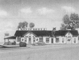
The Black Cat, in the day.
The Black Cat Bar & Grill has been a landmark on the White Horse Pike for generations, offering food, libations and a navigational aid to travelers on their way to and from Atlantic City. As the story goes, it's the oldest business in Absecon and was originally marked by a huge black cat sign with a blinking green eye. My source told me that as a result of Lady Bird Johnson's highway beautification efforts, the larger, operational feline was taken down in favor of a smaller one, though people still ask the owner to restore the blinker.

Using a beautiful-day visit to Forsythe as an excuse for a Route 9 jaunt, I went the extra couple of miles to the White Horse Pike to check out the Cat. The place itself is on an intersection, as all good roadhouses should be, and I had to switch directions to hit it as it should be seen -- from the east with Atlantic City at one's back. I could see why the blinking eye might have been considered a distraction: it's a good sized intersection, and from a certain angle, a driver might take the pulsating green as a signal instead of the installed traffic light.

The non-blinking cat atop the roof.
The building has clearly been updated, but the exterior still exudes a bit of a roadhouse look, including a big sign advertising package goods. "Welcome to Absecon," it said on the bottom, "home of nice people." Well, heck, how can I resist that?

The friendly people part was clear as I walked in and was welcomed by one of the bartenders. Rather than sitting at the bar, I grabbed a nearby booth and checked out the extensive menu. It included a few cat-named dishes as well as a healthy amount of seafood and burger options -- maybe about as extensive as a smaller diner, but without the breakfast choices. I went for a bacon cheeseburger with the California-style works and then took a subtle look around the place. A complete package goods store is set up not far from the bar area, and a more restaurant-y room is at the opposite end. Personally, when I travel alone I tend not to frequent bars, even for lunch, but this felt really neighborly. My biggest problem with the place was what they had on the TV: a Phillies spring training game. Being that I was indisputably in South Jersey, though, I couldn't complain, nor would I have. No sense in testing the boundaries of the Abseconites' friendliness, right? Instead, I quietly enjoyed their two-run deficit.

Any hint of 'rare' was cooked out of the burger, bacon included, but it was both tasty and held together well within the kaiser roll. I really liked the fries -- pleasantly crisp on the outside and just well done enough on the inside. When I bring Ivan the next time, I'm going to try out some of the seafood, maybe the oyster po boy or the crab balls.

Further research says that until about 15 years ago, the Black Cat was a classic shot-and-a-beer kind of place, without food. The public's changing drinking habits prompted ownership to add the dining options, opening up a whole new market. I'd feel comfortable bringing my mom there for a satisfying lunch, and, in fact, an older woman a few tables away from me was enjoying her meal and a conversation with one of the waitresses.

I think we found a new reliable for those Brigantine trips, but maybe with a slight twinge of guilt. Going to the Cat after seeing the birds might be a bit of a betrayal.


Monday, January 16, 2012

An abundance of life, all in the cold

We've been really fortunate this January. Relatively mild temperatures and the lack of measurable snow has made it much easier to explore and go birding in some of the more traditionally productive January target spots. Yeah, we've had to put on a few layers, but the air has been pleasantly brisk, rather than punishingly cold.

This past weekend was the exception. Below-freezing temperatures combined with biting gusts to create some pretty harsh wind chills, despite the bright blue sky. I guess the upside is that all of the precipitation we've had to date has come when the temperatures are warmer. I can deal with the cold as long as I'm dry.

It was in that environment that we headed to the shore for a birding trek to the Brigantine Division of Forsythe National Wildlife Refuge. As longtime readers might recall, we made a few trips last year to Brig, as seasoned birders call it, for ducks and found a bonus bittern and my first bald eagle for good measure. Not bad, overall. Ivan figured we'd pick up snow geese and a few other first-of-the-year species on this jaunt.

On arrival, we found that the refuge was participating in the Federal public lands Fee Free Weekend, where National Parks and Wildlife Refuges waive their normal entry fees to encourage Americans to explore the historic and natural wonders we all own. A sizeable group of people was already in the parking lot, so we headed in the opposite direction, onto the Leeds Eco Trail. Just before we walked into the woods, I noticed what I thought was a snowy egret, standing quietly in the water near a boardwalk. Figuring it wasn't anything huge, I said nothing to Ivan. We're fortunate to see so many egrets that they've become unremarkable.

How wrong I was. After we'd made a fairly unproductive swing through the woods, Ivan spotted that same bird and identified it as a juvenile little blue heron. There went my usual rule of thumb that among the local egrets, the herons are the non-white ones. By now I'm used to this: the young often don't look a heck of a lot like their elders. I guess you could say this adolescent hadn't lost his baby feathers yet. His bill was the real giveaway, though: rather than being yellow like the great egret's, or dark like the snowy's, it was kind of grayish. That was a good lesson for me.

Our next surprise came out in the distance. Ivan noticed some activity on an osprey nesting platform and a nearby perch. We've been seeing so many unusual-for-January birds that it almost seemed plausible that the ol' fish hawks could be setting up shop a full two months before they generally return. Could it be that like so many summer bennies and shoobies, they were setting up their summer shore rental while the best locations were still available?

Or were they not osprey to begin with? Perhaps they were peregrine falcons? My optics and identification skills aren't nearly as good as Ivan's, and I wasn't going to make any pronouncements after my egret/heron miss, but I had a gut feeling. Fortunately another friendly birder was parked nearby and got his scope for a closer examination. Were the characteristic sideburns there? We took turns at viewing the best closeup we were going to get and agreed: these were most likely peregrines. A flight would give us more information to make the call, but all we'd seen so far is a short hop from the perch to the platform. Maybe one of them would entertain us, but the pair seemed more focused on eating the brunch they'd already brought in. Plenty of other raptors were more accommodating, with a few harriers patrolling the marsh in the distance.

Then we saw the granddaddy of all raptors, or, more accurately for this one, the bully kid. An immature bald eagle made its way toward our area, its plank-like wings unmistakable. Our platform diners noticed, too, and one took to the skies to chase the eagle away. For about three minutes, the two put on quite a show for us, the peregrine swooping toward the eagle to hurry the larger bird out of the area.

We all couldn't help but marvel at the sight. Forty years ago it would have been a miracle to see those two engaging with each other, and here it was, playing out in front of us, as natural as could be. It's times like that when I'm grateful for our National Wildlife Refuges and their diversity of life. When you see so many youngsters, you realize how welcoming and healthy the place is, and the presence of so many raptors indicates the robustness of that health throughout the local ecosystem. Everyone goes where the food is, and Forsythe is clearly a pretty good supermarket. That's clear even if you can't identify the birds.

Monday, May 23, 2011

Back to the Brig

Now that the weather is reliably above freezing, it was really a joy to check out Edwin Forsythe National Wildlife Refuge in Brigantine this past Saturday. You'll recall that back in January/February we spent a frozen afternoon there, being dive-bombed by gulls. On an earlier trip, we'd seen an immature bald eagle and an elusive American bittern, but mostly we spent the day avoiding the bitter wind and being very cold.

Fish again?!?!?!?!?!
This time it was just plain beautiful -- sunny and relatively warm -- and it was a good day to check out all of the various environments at the refuge. If the predicted Rapture were to come, there were much worse places to spend one's final hours. It seemed that many other birders were thinking the same thing, so we basically saw where others were going... and didn't go there.

Sittin' on the dock of the bay...
On earlier visits, we hadn't spent very much time in the wooded areas or foot trails, preferring to take the marsh drive in the relative warmth of the car and then bop outside for a few minutes from time to time. This trip, we made some very productive walks about, finding a variety of songbirds and even a beautiful indigo bunting. And while we didn't see much in the way of mammals, other than people, we came upon a couple of tiny toads on the path.

The marsh drive added quite a few shorebirds to the day's take, with a fair number of black bellied plovers hanging out with the ubiquitous gulls. And I have to admit that even as a big fan of great egrets, I was getting a little weary of seeing so many standing amid the spartina.

All in all, Ivan logged over 60 birds (being lazy, I don't keep a list), not a bad take for a couple hours of observation. It's always good to get to the Jersey marshes before the insects get nasty.

Tuesday, February 15, 2011

Dive-bombed by gulls

Another fine portion of our jaunt to Exit Zero was a visit to the Brigantine portion of the Edwin B. Forsythe National Wildlife Refuge. Actually, it was the second visit for me, as we'd been down there during the horrid cold snap a few weeks ago.

The refuge is within the geographic range of the famous New Jersey Pinelands and accessible from the Parkway through a secret exit in a rest stop. Taking that route, you end up on Jimmy Leeds Road, eventually to Route 9 and then the refuge itself. Personally, I find any reference to the Leeds name in South Jersey to be troubling. Leeds, after all, is the Jersey Devil's last name.

Given the amount of snow on the ground on our first visit, we didn't bother with any of the foot trails, preferring to take the drive along the marsh to see the waterfowl. The way the drive is situated makes it relatively easy to bird from the car, provided you see your desired subject in enough time to stop the vehicle and roll down the window. Most of the road is on a series of berms going through the marsh; it's just wide enough to give you room to pull over and stop and still let traffic behind you get through.

Last time we were there relatively early and were able to see some pretty neat stuff, including a bittern (my catch in the grass on the side of the road) and an immature bald eagle enjoying a mid-morning snack on the ice. This time, we were a bit later in the day, closer to dusk. While the marsh had thawed quite a bit, there didn't seem to be anyone remarkable out there. The real story came from the skies.

Or, more accurately, from about 10 feet above us. As we drove along the road, we were occasionally confronted by gulls hovering with morsels in their beaks. They were on a mission: crack open the shell or whatever the morsel was in, preferably on a hard surface. Like my car. Uh, no.

Most of the time, I'd wait them out, watching them hover until they finally dropped their stuff and dived down to collect their meals. Then I'd drive past them and they'd start the process all over again. One of the gulls, though, didn't seem to be getting the drill. He just floated there on the wind, not dropping his stuff and not letting me pass. "This one obviously took the short bus to gull school," Ivan observed. Yes, perhaps.