Showing posts with label community planning. Show all posts

Saturday, December 20, 2014

The silken past of Stirling

Paterson may be nationally known as Silk City, but if you wander around New Jersey long enough, you'll find other places with legacies of weaving the lustrous fabric. A historic marker on Route 206 noting a silk truck hijacking and resulting murder led us to the story of Newton's silken past, and now another informative plaque further proves that the Great Falls area didn't have an exclusive on mills.

A few weeks ago I was meeting a friend for lunch in the Long Hill community of Stirling when I came upon this description of the village.


Given the placid, sometimes rural charm of much of Morris County, it was a bit of a surprise to discover that Stirling had been an industrial town. Looking around, I saw only a small business area surrounded by suburban houses. We've been to plenty of factory towns, and Stirling doesn't look like one. If there was a story to be told, I'd have to do some digging.

As it turns out, the hamlet of Stirling owes its existence to the foresight of an insurance company and a railroad. Shortly after the Mutual Life Insurance Company of New York announced interest in investing in Morris County land in the late 1860s, the Passaic Valley and Peapack Railroad purchased land in present day Stirling for the construction of a railroad station and right of way. Trains started running in 1872, and the line would eventually extend to the Delaware River, raising the prospect of Pennsylvania coal being shipped through the new community. Organizers named the community for William Alexander, Lord Stirling, the Revolutionary War notable who'd once owned land in the area.

Reliable transportation made it easy to bring in raw materials and labor, and ship out finished product, but first a town needed to be built. Bit by bit, the village came together, starting with eight houses and a railroad depot, followed by a Presbyterian church. The first factory was built on Railroad Avenue to make buttons; it eventually employed 125 people. By 1885 the plant was silenced, victim of an economic downturn, and the entire village, houses and all, was put on the market.

The Stirling silk mill
Silk came to Stirling in 1886 when Jersey City mill owner Claude Chaffanjon bought the factory and surrounding buildings and homes. Having immigrated to the United States years earlier, he brought skilled Italian and French weavers to work in the mill; as was the custom in Europe, many others came with looms of their own and weaved in their homes. The boon in population and industrial output brought growth in the community, too: Chaffanjon donated land for a new Catholic church, and an additional public school was built.

Chaffanjon's stay in Stirling was brief; within a year he'd sold the factory to Julius Schlachter, who brought German and Swiss weavers to town. In 1896 the mill burned down, replaced a year later by a new building. Within 25 years of the opening of the original mill, Stirling's population had become a veritable map of Europe, with Armenians, Germans, Italians, French, Hungarians and Russians mixed with the local born population. Their children generally attended school up to the eighth grade, foregoing high school to follow their parents' path into the mills. When Stirling Silk went bankrupt in 1908, it was bought by the Swiss company Schwartzenbach-Huber.

Though 30 miles away from the state's silk hub, the mill at Stirling wasn't immune to the labor unrest that struck Paterson. A June 1915 New York Times article notes that months of unrest followed management's decision to enact a new wage scale, and that several looms were being sent to other Schwartzenbach-Huber locations in Bayonne and Pennsylvania, presumably where labor was more compliant.

Nor was the Stirling plant protected from a wave of silk thefts that swept the region in the early 1920s. The fabric was a hot commodity - foreign suppliers were still recovering from the ravages of World War II, making U.S.-manufactured silk that much more desirable on the open market. A few months after thieves hijacked a silk mill truck on present-day Route 206 in Sussex County, thieves struck Schwartzenbach-Huber. On November 24, 1924 three masked and armed bandits broke into the factory and beat a 60 year old night watchman unconscious when he confronted them. After restraining him with cloth, they pulled a getaway truck up to the shipping dock and loaded it with 50 cases of silk worth a total of $35,000.

Stirling's silk days have been over for the better part of a century. Schwartzenbach-Huber had sold the mill and housing in 1928, but the weaving trades continued in much smaller companies around the village up to about 1940. As for the old silk mill itself, it burned to the ground in 1974 in its incarnation as a polyurethane foam factory.


Tuesday, November 4, 2014

Palmer Square: Vintage Colonial charm, circa 1937

Walk around Princeton's atmospheric Palmer Square, and you'd be excused if you thought parts of it had been there since the American Revolution. Small shops with brick facades are interspersed with wood-faced neighbors, and the picturesque Nassau Inn stands in the center, seemingly having been there forever.

However, Palmer Square is much younger, a planned development built in the 1930s. Its construction brought the destruction of a local institution with a legitimate link to colonial times, as well the relocation of a thriving African-American community.

A portion of Palmer Square, Fall 2014.
Given how central Palmer Square is to the contemporary image of Princeton, and how convincingly old it looks, it's difficult to conceive the town before it was built. Edward Palmer, a Princeton alumnus and heir to the New Jersey Zinc fortune, envisioned a mixed-use development that would become the new focus within the town. In the late 1920s he began to quietly acquire property just a few blocks west of the University gates, between Nassau Street and Jackson Street. He hired architect Thomas Stapleton to design shops and office buildings that, though united, would appear to have been built over an extended period of time.

Typical for 20th century redevelopment projects, Palmer's vision meant displacement for some of the community's less prominent residents. In this case, it was members of the black community, many of whom worked in service positions around town and at the University. As the land for the project was cleared, residents were moved eight blocks north of their previous neighborhood, creating a new 'edge' of town. With them went several houses; new dwellings were built for those whose homes couldn't be salvaged. The project also erased two roads: Baker Street, which intersected Nassau, and Nassau Place, which had been a service road for coaches.

The original Nassau Inn (College Inn) on Nassau Street.
Photo from the Historic American Buildings Survey/
Library of Congress
The Nassau Inn was was to be the focal point of the development, but ironically the lovely Colonial-style building we see today took the name of a 1757 structure that was razed in the name of progress. Originally built of brick imported from Holland, Judge Thomas Leonard's home was known as the finest in Princeton for its day, and eventually became widely known as the place to stay as the town became an important stop on the stagecoach route.

A hotel since 1769, the original Nassau Inn had stood directly on Nassau Street, eventually absorbing the adjacent Mansion House built in 1836. At its start, the inn had been known as "The Sign of the College" or "College Inn," and had hosted commencement dinners for the original College of New Jersey until the Revolutionary War forced an end to the tradition. According to local lore, Paul Revere and Thomas Paine visited during wartime, as did several signers of the Declaration of Independence.

In later years, the building hosted the annual commencement ball, though Princeton students were ordinarily forbidden from visiting the tavern. According to notes from the Historic American Buildings Survey, New Jersey Legislature committees often held meetings at the inn, as well. It appears that by the time the building was brought down, it bore little resemblance to the hostelry Washington Irving had visited on an 1813 stop in Princeton.

Though the neighborhood -- and the Inn -- had received their death warrants in the late 1920s, the advent of the Great Depression put the project on hold until 1937. The WPA Guide to 1930s New Jersey notes that construction was to be completed by 1941, but in reality, pieces and portions of the project have evolved over the decades. More stores, an office building and luxury apartments have all been added in the past 20 years.

As for the old inn, only a few relics remain: a stone platform that now graces the Nassau Inn's Yankee Doodle Tap Room, and the old Nassau Inn sign salvaged by Princeton students in 1937.   


Wednesday, September 24, 2014

Under the sea: the (partially) lost resort of Sea Grove

Standing on the beach at the very tip of New Jersey during our most recent birding jaunt, my mind went back to a curious story I’d heard a while back. The quiet residential area just off the beach had once been much larger, but about a quarter of it had been wiped away, victim to erosion and a series of storms.

The Jersey shore is no stranger to destruction, as anyone who survived Hurricane Sandy can tell you. The 2012 storm was nowhere near the first round where man’s work was KO’ed by Mother Nature. As I discovered, though, the Cape May environs has gotten nailed more than a couple of times, erasing large swaths of beach developments from the map.

In fact, the very stretch of sand where we scanning gulls and terns had actually been a street called, ironically enough, Beach Avenue and the riprap jetties poking from the sand into the ocean are built essentially on what were once the cross streets. This was the southernmost portion of the town of Sea Grove, one of the many religious-themed communities founded in the years following the Civil War. Unlike Mount Tabor, Pitman Grove and Malaga, however, it wasn’t created by Methodists, nor did it come close in popularity.

Philadelphia cotton merchant and devout Presbyterian Alexander Whilldin originally secured ownership of the area, once known as Stites Beach, through marriage; his wife Jane's family had bought the land in 1712 through the West Jersey Proprietors. After first incorporating the West Cape May Land Company in 1872, he joined forces with retailer John Wanamaker and a group of real estate speculators three years later to create the Sea Grove Association, which purchased 266 acres from Whilldin for five dollars. The association’s goal, as stated in its bylaws, was to “furnish a moral and religious seaside home for the Glory of God and the welfare of man, where he may be refreshed and invigorated, body and soul, and better fitted for the highest and noblest duties of life."

Sea Grove directors claimed that while the typical seaside resort of the day focused on "lavish display, extravagant living... and consequent expense to be regretted when the apparent pleasure is past," visitors at their community would experience "good living." The temperance-minded organization forbade both alcohol and amusements, envisioning a quiet community unlike the much busier Cape May City a few miles to the north.

Taking a page from Pitman Grove, Philadelphia architect J.C. Sidney arranged the town’s main streets to radiate from a central hub, on which an 15,000 seat octagonal worship pavilion would be built. A separate corporation was founded to build houses and hotels, offering ministers $500 lots to encourage them to settle in the town. And to make it easier for potential residents to get to the remote community, the Association promised a free West Jersey Railroad pass to Cape May City for everyone who built a cottage in Sea Grove, and built an additional horse-drawn passenger train to ease the final leg from the station to their new summer home. Visitors and summer residents were welcomed to the community by an ornate gate that was meant to resemble the gates of heaven.

A 1876 "bird's eye" view of Sea Grove.
To accommodate those who didn't want to purchase property, the Association built the Sea Grove House overlooking the shore. Small shops opened to serve the community’s needs, given the distance into Cape May City.

The Sea Grove Association quickly sold out its 275 residential lots, but its salad days were few. Troubles started surfacing as early as 1879, even as other religious communities around the state were thriving. What’s for sure is that the investors took a bath. While the entire project had cost somewhere in the neighborhood of half a million dollars, the property, including the pavilion and boarding house, were sold for just $120,000 in 1881. The pavilion was removed in 1881, its wood sold as salvage, leaving a field that’s still largely empty. The Sea Grove House had a slightly more positive fate, operating as the Carlton Hotel until 1910.

Following the failure of the Sea Grove Association, the community incorporated as the Borough of Cape May Point. The intervening years brought a series of storms that severely eroded the area south of Cape May City, virtually destroying South Cape May (a story for another time) and engulfing the Point's Beach Avenue and several intersecting blocks.

Today, the community holds about 600 seasonal and year-round homes. It’s still a quiet place, with no boardwalk, no liquor stores or bars, and no motels. Its two retail businesses say a lot about the community’s attractions: a general store, and the gift shop at New Jersey Audubon’s Cape May Bird Observatory.

And a quick glance at the part of town nearest the beach betrays none of the devastation of surf and storm. The streets that lost length to the sea have been squared off with their cross streets, creating elbows where there were once four-way intersections, with dunes piled up as protection. It's seemingly only St. Mary's By the Sea, a resort turned Catholic retreat center, that appears poised to be taken away with the next big wave. One can imagine the Sisters pray nightly for reprieve.


Saturday, September 13, 2014

Winfield Park: born of war, a battle to build

If you look through the trees along the northbound side of the Garden State Parkway northbound, just before exit 136, you might notice an enclave of small dwellings, many connected to each other. These nicely kept one- and two-story buildings look a bit like modular housing, yet there's an air of permanence to the entire area.

You've just passed the town of Winfield, a proud enclave of just under 1500 people on a triangular 0.177 square miles of land bordered on two sides by the Rahway River. It's basically a sliver of land between Cranford, Linden and Clark, so small there are only two roads in and out of town. Many in Union County know it as a tight community where generations of families have lived in what was originally built as temporary defense worker housing during World War II.

That's partially true: residents have always been close-knit, and the town was built for defense workers, but the houses were always intended to be permanent. And Winfield holds a unique distinction among American towns: it's the only defense housing project to be established as a separate municipality.

Winfield has its roots in the months before America entered World War II. The U.S. Government's Federal Works Agency had created the Mutual Ownership Defense Housing Division to build suitable dwellings for the multitudes of workers who were being hired by manufacturers and shipbuilders supplying the armed forces and America's allies. The low-cost, permanent housing would be a boon for people who lacked enough money for a down payment: the government planned to sell the developments to their resident-owned and operated housing corporations.

Need for housing was particularly acute for employees at the Federal Shipbuilding and Drydock Company on Kearny Point, and the FWA set to work to find a large enough piece of land on which to build 700 housing units. Another 300 were built in nearby Newark and Harrison.

Actually locating the development wasn't easy, for both logistical and political reasons. The ideal location would be close to utility networks but in a community where those facilities were underused and land was inexpensive. Open tracts in and immediately around Kearny were largely marsh and easily ruled out as too difficult to develop quickly, forcing the FWA to look farther afield. Ultimately, they investigated seven different communities as possible locations.

Nearly 20 miles away, a small bit of land by the Rahway River in Clark looked ideal. Then the political challenges emerged. While Clark officials had courted the project, their constituents were concerned that the influx of new residents would change the town's character. Taxes were anticipated to double as the cost of services would increase while no new rateables would be built with the community. The issue became so contentious that the entire slate of officials who'd encouraged the project were voted out.

With local government now led by sympathetic officials, opposition leaders then came up with a plan to ensure the defense worker community would have no impact on the town's finances. If they couldn't stop the project, they'd find a way to get it declared an independent town with its own budget, taxes, services and public works obligations.

That's exactly what happened. Just after construction began on the project in June 1941, one of Union County's state assemblymen introduced a bill to establish Winfield Park as a municipality. Through legislative sleight-of-hand, the bill was rushed through both houses without opportunity for discussion or public comment. Governor Charles Edison refused to sign it into law, declaring it to be counter to the needs of national defense, but his veto was easily overturned. For better or worse, Winfield Park was now a municipality -- the only one in New Jersey owned lock, stock and barrel by Uncle Sam.

Opponents inadvertently helped create a sense of camaraderie and self-determination among Winfield residents, starting when the first pioneering 145 families moved into the incomplete town in November 1941. What they found when they arrived was less than ideal -- shoddily built homes with inconceivably poor plumbing, muddy roads and sidewalks, and no electricity -- but they made do. After residents went on a rent strike to underscore their grievances, Federal investigators found the contractor guilty of fraud and bid manipulation, forcing the FWA to hire a new company to finish the project.

Still, Winfield Park residents soldiered on, creating a town from scratch. Defense workers headed to work on a government-supplied bus (when it wasn't broken down) as their families got to know each other. Friendships grew and clubs formed, along with a volunteer ambulance squad and co-op grocery store. A grammar school opened to much fanfare in 1943. And as was originally envisioned, the Winfield Park Mutual Housing Corporation purchased the entire town from the U.S. government in 1950, paying off the mortgage in 1984.

Inevitably, with the arrival of the Garden State Parkway and greater suburbanization, the land on which Winfield sits became more valuable than the homes and small commercial area sitting on it. Though developers have periodically approached community leaders with various proposals for redeveloping the area, the residents have always said no. It appears that they like where they live and who they live with. Why change it now?


Tuesday, June 10, 2014

Belco: (not) a blast from the past in the Pinelands

Acres and acres of pitch pines and other evergreens obscure the remnants of industry that once dotted the Pinelands. Land cleared for pig iron foundries and papermills in the 1800s has now been overtaken by regrowth, rendering the old factories difficult to locate. Other, more accessible abandoned industrial sites like the Estell Manor glassworks are easily visited within Atlantic County parks.

What we didn't realize on our original visit to Estell Manor was that there was a larger and more recently-built and abandoned factory community nearby. In fact, a good part of the park now stands on the grounds of the World War I era munitions manufacturing site and proving grounds known as Belco. Just outside of the former blast range, the companion factory town of Belcoville is still alive and well.

New Jersey's contributions to the war effort began well before the United States entered the conflict in April 1917, with several suppliers manufacturing ammunition for our allies. Once we were formally in the conflict, four additional factories were constructed around the state by various defense contractors, including the Bethlehem Loading Company, or Belco. Under the direction and supervision of the U.S. Army, Belco cleared about 10,000 acres of marshy pine forest along the Great Egg Harbor River to build the factory along with the nearby village of Belcoville to house more than 3000 workers and their families. An adjacent proving ground was to be the largest testing site of its kind in the world.

Storage facilities for loaded shells.
Courtesy Atlantic County Government.
War is a great motivator for rapid construction, and Belco is a case in point. Work on the factory site and village began simultaneously in early 1918, continuing non-stop, seven days a week. A subsidiary of the Bethlehem Steel Company, Belco was the only ordinance contractor to supply shells from mining the iron ore through forging the steel, machining, loading and assembling the final product. The site at Estell Manor was responsible for the loading and finishing stages, requiring both factories and complex safety measures to address the highly explosive elements that employees would handle.

The self-contained plant included everything that would be needed to keep production moving, including a power generator, water works, personnel offices, machine shop, blacksmith and carpentry areas, and storage facilities including reinforced powder magazines. A barracks held 1100 soldiers who guarded the plant against potential sabotage, a threat already felt from explosions at Jersey City's Black Tom Wharf and the Canadian Car and Foundry munitions plant in Kingsland.

Safety was paramount. Plants were built at distances to ensure that a fire or blast in one would not set off a chain reaction. A modern water pump and main system included special valves to ensure that firefighters would have adequate water pressure even if part of the system was damaged by explosion. Much of the plant was constructed of wood to prevent sparking that could set off fires, and escape chutes were built into the second floors of the plants, leading to protective ditches. Changing houses were built for both male and female workers to ensure that employees wouldn't track poisonous TNT residue out of the loading areas.

As a result of these measures, Belco was a reasonably safe place to work, and no fires or blasts of note caused significant worker injury or damage to the plant. No employee ever suffered from TNT poisoning though more than 17,000 such incidents occurred at other plants around the country. Nevertheless, a 100-bed hospital stood ready to address injuries and illness.

By July 1918 the first 155 millimeter shells were being filled and rolling off the assembly lines, even as construction work continued on additional factory buildings. Meanwhile, employees enjoyed the benefits of living in modern housing at nearby Belcoville, with running water and heating as well as community amenities like a school, bowling alley, shopping district and YMCA/YWCA.

Belcoville housing ranged from dorms for single employees
to large homes for supervisors with families.
Courtesy Atlantic County Government.
Just four months later, with about 70 percent of the plant built, the war ended, though Belco continued to turn out munitions for several months afterward. Plant buildings were dismantled and sold for scrap, leaving only the concrete foundations. Many of the newly-vacant worker houses were sold, taken down and moved to other locations in the area, while many employees remained in Belcoville to keep the community going.

Belco is listed on the New Jersey and National registers of Historic Places, and Ivan and I visited some of the roads and ruins recently, guided by an informative booklet available at the Estell Manor Park Nature Center. On a warm, sunny day, the gnats were in full force, accompanying us as we walked the broad main path into the complex.

Had we not already known that a busy manufacturing plant had been there less than 100 years ago, we'd never have been able to tell. Roadways are still evident from the long, reasonably straight breaks between trees, but many of the side streets are little more but wide strips of overgrown grass marked with wooden signs.

The booklet points out the sites of several Belco buildings which are a 10 or 15 minute stroll from the visitor center (depending on whether you stop to look for the stray cuckoo or vireo calling from the trees). We found the footings or a water tank and the machine shop, blacksmith and carpenter shop before the gnats got to be too much for us. There's more along the other paths, but from what I understand, most of it is along the lines of "you need an imagination to see it." No doubt, a late fall, winter or early spring visit might be more productive for those wanting to find more of the ruins.

Still, a hike through Belco is thought provoking. If such a busy industrial site can revert to virtual wilderness so quickly, what potential is there for other highly-developed tracts to be reclaimed by nature? So much of New Jersey has been paved over, some to great benefit and some not. Maybe sprawl isn't irreversible after all, and maybe old industrial sites can, with some effort, host wildlife once again.

Oh, and if our experience is any indication, it's a wonderfully reliable place to find Yellow-billed cuckoos. During our visit, we saw at least four, including a pair perched comfortably beside each other not far into the woods from the trail.


Saturday, May 3, 2014

Back at camp: the continuing revival at Malaga

So... I left the house this morning thinking I was on a somewhat religious journey, but I ran into something I didn't expect.

I was on my own. Ivan was out on a separate birding adventure, so I chose to do some exploring in parts somewhat lesser known. Ever since my trip to Upper Deerfield Township to learn about Seabrook Farms, I've been curious about other agricultural developments in the area, particularly a group of settlements of Jewish farmers in Salem and Gloucester Counties. Their names - Norma, Brotmanville, Rosenhayn, Alliance - are still on the map more than 100 years after their founding, but they're not as easily located via road trip, as I found out today.

Thing is, when you wander around the southern reaches of the state, particularly in those more rural counties, a wrong turn becomes another adventure all together. Looking for what may be the world's smallest synagogue, I got all turned around and ended up on Route 47 in Malaga.

Just as interesting as a tiny shul, I discovered a colony of small houses set on narrow streets that could only be one thing: a Methodist camp meeting ground. Yup, I'd found Malaga Camp, since 1869 the location of the West Jersey Grove Association. The exteriors of the homes are a bit less colorful than what we'd seen at Mount Tabor, and the narrow streets are in a grid rather than the spoke-and-wheel arrangement at Pitman Grove, but the central tabernacle made it clear that this is a place where people come to worship.

Like the other two camps, Malaga started as a summertime revival tent community. Unlike Mount Tabor and Pitman Grove, however, it's retained its original purpose as a place of reverence by strictly managing the composition of its population.

Those who purchase cottages in the camp are required to meet three requirements, as set forth in the membership process: they must give testimony of their personal salvation in the Lord Jesus Christ, be an active member of a church for at least two years, and have been actively involved in the life and work of the camp meeting for at least one year. References are requested and checked, and applicants must undergo an interview with a committee of members. When approved, an applicant can purchase a cottage, leasing the property below from the camp association. 

Only about half of the 140 houses are kept as year-round residences, allowing the camp association to maintain the small-town feel by avoiding overcrowding. Bylaws forbid property owners from renting to non-members, but a guest house on the property is available for visitors, families and retreat groups. As I was driving around the community, I constantly had to stop at four-way intersections at the end of short blocks, so I wasn't surprised to learn that many people use golf carts to get around during summer months.

After a little bit of exploring by car, I felt I needed to let Malaga back to its peace for a spring Saturday. I'd seen one person -- another motorist who approached an intersection the same time I did -- and she'd kindly waved me forward ahead of her. Having found these tiny houses on a small tract on the side of the road, and maybe gotten a little heavenly nudge in the right direction, I headed off to find that little shul.


Thursday, February 13, 2014

Would Peter Stuyvesant live here? Discovering Teaneck's Warner District

Take a drive around Bergen County, and you're likely to pass a few Dutch Colonial houses that predate the founding of the United States. Built of sturdy stone, many are still occupied as private homes, maybe even surrounded by a development of houses of more recent vintage.

That said, we were kind of surprised to see a small enclave of them on busy Cedar Lane in Teaneck, near the corner of River Road. Had they been moved there in some sort of preservation effort like East Jersey Olde Towne in Piscataway or maybe as a real estate scheme like Wychwood in Westfield?

Actually, no. Despite their aged appearances, the structures are less than 100 years old. And when you study the development a little more closely, you start noticing similarities in construction, reminiscent of 20th century tract housing.

We'd stumbled on the Fred T. Warner Historic District, an early 20th century attempt to recreate the charm of Teaneck's rural Colonial past while meeting the community's evolving housing and commercial real estate needs. Between 1926 and 1938, architect and Teaneck resident Warner constructed a miniature village of homes, garden apartments and even office space for a rapidly growing town. It might not have been as expansive or ideologically-driven as Radburn, but it was unique in its own way.

The Cedar Lane boundary of the 40 building development includes several Dutch Colonial structures, including an office building that the casual observer might think was converted from a large old house. Garden apartments are nestled off the main road, arranged to create a cozy courtyard. Houses in a variety of sizes, some wood or brick, line narrow, winding side streets to create what looked like a storybook setting in the snow.

Like Radburn, the Warner district addresses several housing needs with apartments, small rental houses, duplexes and dwellings for larger families. Proximity to New York was quickly transforming Teaneck to a commuting town, and this mix of housing options provided a necessary stepping stone to support growing population density while retaining the town's intrinsic charm.

Warner bought the land from the estate of William Phelps, which generously agreed to a repurchase and rent-back arrangement when the onset of the Great Depression threatened the project's completion. And as it turns out, his choice of building materials was based on thrift as much as on a dedication to authenticity. He'd bought more than $35,000 worth of stone ahead of another venture he'd been commissioned for, and when that project failed to materialize, he found himself with tons of construction material crying for a use.

Absent the blue historic marker or local knowledge, the average passer-by would have a hard time differentiating the Warner District from its much older, more storied stone brethren, and perhaps that's a good thing. In a time when McMansions and cookie-cutter construction seem the norm, it's nice to run into more authentic-looking replicas of our past. Even if some of them might be a little cookie-cutter themselves.


Wednesday, November 27, 2013

Piscataway's brush with anarchy: the Stelton Modern School and Ferrer Colony

A few weeks ago we explored the Stelton area of Piscataway to tease out the history of early 20th century settlement there. You might recall we were trying to figure out the differences between Friendship Farm, the Ferrer Colony and an unnamed (at least to us) community of chicken farmers.

Distinguishing one from the other proved to be a little bit of a challenge, as many sources refer to Friendship Farm and the Ferrer Colony in the same breath. In truth, they were quite different. While Friendship Farm was largely the province of formerly-urban and taciturn German transplants, the Ferrer Colony took a decidedly anarchist turn, fostered by adherents of Spanish educator Francisco Ferrer.

Well-known for his political beliefs, Ferrer had founded the Escuela Moderna in Barcelona in 1901 as a means of promoting the tenets of anarchism. After he was executed for his alleged participation in an insurrection, free-thinkers around the world, including some in New York, sought to perpetuate his teachings through additional Modern Schools.

Relief sculpture on the side of the Goldman house
in the former Ferrer/Modern School Colony.
The prompt for the Modern School's move to Stelton came through two sources: a vision and a bomb. Troubled by the "evil influences" of the city, founders of the New York Ferrer movement theorized that they'd be far better able to effect social change if the school was physically cocooned within a supportive community of like-minded individuals. Meanwhile, students from the school's adult classes were linked to a 1914 explosion that was said to be a bomb intended for the Rockefeller family. Overall, Manhattan was turning out not to be such a great place to be an anarchist.

Not long after the blast, one of the Ferrer group leaders was visiting friends who lived at Friendship Farm when an a solution materialized. Dissatisfied with the Farm's conservative environment, one friend suggested that the New York group could purchase the adjoining land and start their own settlement in New Jersey.

One of the Ferrer Colony's remaining tiny houses.
Compared to a cramped existence in Manhattan, the Stelton farmland must have appeared as nirvana. The Ferrer group bought 143 acres of land and subdivided it into one- to two-acre plots to be sold at a profit to individual members. Sale proceeds would be used to construct roads and other shared facilities. Like their Friendship Farm neighbors, the Ferrerists built their own homes; many were, by today's standards, ridiculously small (as in, they make the classic Edison concrete houses look like McMansions). The land itself was reportedly treeless, dusty and devoid of a water source. Roads were meant to be built as a communal effort, which didn't work quite as cooperatively as the founders had envisioned. Common facilities, like a dormitory for students coming in from New York, were only completed after severe financial difficulties.

Through it all, the ever-important Modern School attracted the support and attention of parents who wanted their children to benefit from a progressive, if not revolutionary education. The school had no curriculum or study requirements, supporting the community's belief that allowing students to make their own choices would result in responsible adults. After a brief morning gathering, kids could experiment with several options, including outdoor games, woodworking and art. Traditional academics were available but not forced; oral histories note that some children didn't learn to read until they were nine or ten years old.

The school and community persisted through the lean years of the Great Depression, losing many students whose parents couldn't afford tuition or had become communists. World War II seems to have struck the death knell; the construction and operation of nearby Camp Kilmer reportedly brought crime and hostility to what had been peaceful farmland. Nonetheless, the Modern School managed to stay open until 1953, most of its few students reportedly around kindergarten age.

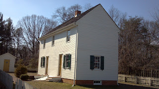
Today, the only overt sign of the Modern School is a plaque erected on the site where it once stood, 79 School Street. Though many of the common buildings have been torn down and replaced by retail establishments, some of the small houses still stand in the general area, including the Russian, or Goldman house, notable for the bas relief artwork on its outside walls.


Friday, October 25, 2013

Fellowship Farm: a social experiment in the exurbia of Piscataway

Over the past couple of years, we've found a host of planned communities and colonies that were built around New Jersey. They're usually pretty well defined geographically, off on their own in places where land was once inexpensive, and clear signs of them are evident.

Then there are the two in Piscataway whose vestiges lay somewhat obscured. Concealed in suburban neighborhoods just a few blocks from Rutgers University's Busch Campus, evidence of the Fellowship Farm cooperative and the Ferrer colony and Modern School is limited to a plaque on a rock, a couple of small homes and an interestingly-named grade school (whose playground sports a rock that seems to have once had a plaque on it).

There might even have been a third community in the town that had once been mostly farmland and undeveloped acreage. About a year ago, Ivan and I found a curious historic marker just off Busch Campus. It memorialized the site of a poultry farm once run by a Jewish community that had settled there courtesy of Baron Moritz von Hirsch, a philanthropist who had set up a trust fund for Jewish immigrants in the U.S. Initial research revealed nothing, and it's been on my long-term "to research" list since then.

Instead of getting to the bottom of the Middlesex County poultry mystery, I've found bits and pieces of information on collective chicken farms that were organized in more southern and remote parts of the state, well worth a visit and future coverage in Hidden New Jersey. In the process I found information on the Ferrer Modern School, a social anarchist educational system that was once the center of a colony organized in Piscataway. Could this be related to the von Hirsch-sponsored chicken farms? I wasn't sure, but it was enough of a lead to warrant a search for the marker Ivan and I had found. The Ferrer group had settled in the North Stelton section, near Busch Campus. It had to be the same place, right?

Maybe, maybe not. The info I had on the Ferrer colony advised that members had built tiny houses in an area just off Stelton Road, and that a few still survived, along with a plaque marking the site of the Modern School. I found the houses, but as I was wandering around, I found something else that got my curiosity up. Very close to those little houses, but on the other side of Stelton Road, was the Fellowship Farm School. That name was just a bit too, well, communal-sounding not to have something to do with a collective of some sort.

It was, indeed. It seems that in 1912, German Socialists living in New York City had seized upon the ideals of Unitarian minister and emerging commune organizer George Littlefield, who had promoted the creation of several Fellowship Farms around the country. Advertisements for the New Jersey outpost encouraged city residents to "get back to the land," and a small group heeded the call. Together, they raised $8000 to buy a total of 162 acres in North Stelton, dividing it between a large communal plot and separate one-acre segments to be purchased by individual members. Plans called for each potential member to purchase a $10,000 subscription and pay a $50 per acre fee for their land, as well as a $5 monthly installment.

In theory, the plan sounds rather nice. Income would come from farming, as well as proceeds from raising poultry, hosting summer tourists and undetermined work that residents would do in their own homes. Members could also choose to take on part-time employment in businesses outside the community.

The reality seems to have been quite different. As is often the case in utopian communities, the founder's dream seems to have downplayed or ignored the fact that the romantic desire to 'work the soil' doesn't automatically convey the skill to raise crops. Rather than farming their land, many of the former city dwellers built small bungalows and continued to work at their jobs in New York, perhaps raising chickens on the side. Even the bus line and market that had been communally operated were transferred to private operators over time as colonists recognized that representative governance isn't the best way to run a business. The one community enterprise that seems to have worked well was a cooperative garment factory that prospered during the Great Depression.

Confusion over the relationship between the Fellowship Farm and Ferrer colonies is evident in much of the reference material I've read, but they were definitely two very distinct groups despite their proximity to each other. The largely German-speaking Fellowship Farm members were described as moralistic and staid, repelling freer-spirited socialists who sought entrance to the community. It seems that the Ferrer group settled nearby merely because the land was available.

I've found very little information on the demise of Fellowship Farm, but I'd venture to guess that life changed greatly in the area during and after World War II. Nearby Camp Kilmer was a major training and embarkation station from 1942 until the end of the war, spurring development in the surrounding area. Increased activity shattered the peace and calm so many community members valued.

In any case, all indications are that Fellowship Farm wasn't, as I'd hoped, the same community memorialized by the blue historic marker Ivan and I found last year. That one remains a mystery to be investigated. And what of the Ferrer Colony? We'll be telling that story in a future installment.


Thursday, July 25, 2013

Anchors aweigh in Brooklawn: the hidden naval history of Noreg Village

Wrong turns can lead you into some puzzling places, as was reconfirmed to me recently. I was driving along Broadway in Gloucester City, looking for the waterfront and Proprietors' Park, when I overshot and ended up driving through a very compact housing area. Uniformly-designed, smallish stucco houses, both attached and unattached, stood on postage stamp-sized lots along narrow streets barely wide enough to accommodate two cars across.

The neighborhood put me in the mind of company housing, arranged on a modified grid. One road wound against the Delaware River and a small inlet, marking the outside border of the neighborhood. Other roads branched from a central Paris Avenue like veins on a leaf, with names evoking the local geography (Pennsylvania, New Jersey) and World War I (Pershing, Marne). It all seemed to have been planned to get the maximum density of housing into a peninsula hemmed in by river and creek. Might this might have been a quickly-built village for workers at the Gloucester City and Camden shipyards?

A recent look at Noreg Village housing
That, as I discovered later, was exactly the case. Shortly after the United States entered the war in April 1917, the Navy ordered 30 destroyers and other ship components from the New York Shipbuilding Corporation, prompting the company to ramp up work at its Camden shipyard. Additional workers poured into the region to supply labor, but they needed places to live and house their families.

In a strategy that would later be echoed in World War II developments like Winfield Park and Victory Gardens, the federal government financed the construction of homes for about 6500 shipyard workers in a riverside portion of what was then known as Centre Township. Built by the U.S. Shipping Board Emergency Fleet Corporation, the middle-income community was completed in 1917. New residents surged into the neighborhood, which was then called Noreg Village.

In 1923, well after the end of hostilities in Europe, the government held a massive auction of the 450 properties, including some commercial buildings and undeveloped lots. Home prices ranged from $1875 to $4000 for two- and three-bedroom properties described in promotional materials as the "ideal place of residence" for "the highest type of men and their families."

Brooklawn was officially formed as a borough in 1924 when it joined a growing number of hamlets separating from Centre Township by referendum. (Lawnside did the same two years later, rendering its parent township defunct.) Now home to about 2000 residents, its residential stock includes additional homes built to the east of Broadway, the road I'd taken to discover this little-known evidence of New Jersey's contribution to America's World War history.


Thursday, March 28, 2013

Victory Gardens: a tiny town with an interesting past

Our tour of tiny enclaves continues with Victory Gardens, which is not only the smallest and most densely populated, but the youngest municipality in Morris County. Created by an act of the state legislature in 1951, the borough also has the distinction of being perhaps the only New Jersey community whose electorate voted against seceding from its host municipality, but got cut adrift, nonetheless.

How did this confusing turn of events happen to be?

As you might have guessed from the name, Victory Gardens was born during World War II as housing for workers who were employed at nearby Picatinny Arsenal and other private defense contractors manufacturing war goods. It was built quickly: the Federal government determined the need shortly after the bombing of Pearl Harbor on December 7, 1941, and within six months, it had constructed 300 housing units, streets and supporting infrastructure on about 90 acres of land in Randolph. The community was named for the victory gardens that loyal Americans were planting on their own property to free up farmers' crops for the war effort.

The influx of new people in Randolph seems to have caused some discomfort among longtime residents, which was allayed somewhat by the Federal subsidies that came to the town in exchange for the new construction. However, the climate changed after the government payments ended along with the war. A great many Victory Gardens residents were Democrats in what was otherwise a very Republican area, which made some Randolphers uneasy. Looking toward separating the newer community from its host, Randolph officials held a referendum in September 1951, and voters narrowly agreed that Victory Gardens should be spun off.

This has to be the most cost- and space-efficient
war memorial out there. 
Only problem was, the folks in Victory Gardens overwhelmingly wanted their neighborhood to remain in Randolph. Out of 513 votes cast in Victory Gardens, just 30 approved of the secession plan. Cast from their municipal home, the community approached neighboring Dover with the idea of affiliating there, only to be turned down. Thus, they were on their own.

Victory Gardens continues, looking a lot like a housing development off of South Salem Street, not far from Route 10. Its compact homes are clustered on streets named after a few presidents, most of whom are predictable (Washington, Roosevelt) and a few that aren't (Polk, Garfield). A condo complex was added to the town in the late 80's, but the community remains small, at around 1500 residents.

In researching, I found three other defense-related communities in New Jersey -- Audubon Park and Bellmawr Park in Camden County, and Winfield Park in Union County. They differ from Victory Gardens in that they were created by the Mutual Ownership Defense Housing Division of the Federal Works Agency. All still exist today. We'll be taking a look at Winfield, specifically, in a future Hidden New Jersey report.

Monday, March 25, 2013

Free Acres is the place to be...

If it hasn't already become obvious, I'm intrigued by planned communities. There's something fascinating about an enclave where people choose to live together based on a common noble belief, as long as it's benign.

Such is the story of Free Acres, a 70-acre residential community nestled in the Watchung Mountains. Roads barely wider than a driveway will bring you through a peaceful wooded settlement of homes, some bungalows, others the size of an average subdivision house. Just inside the boundaries from the outside road is a two-story red farmhouse, which serves as the community gathering place.

Founded in 1910 by a preacher's son named Bolton Hall, Free Acres was started as an experiment of the "single tax" philosophy of Henry George. A writer and economist by trade, George believed in the common ownership of land for the community's benefit. Or, as the association constitution says, "all shall be mutually helpful and free from all forms of monopoly of natural resources, in order to secure to all equality of opportunity and a full reward of efforts." Land was considered a mutual birthright of humankind, to managed democratically.

Hall purchased the Murphy farm on the border of Berkeley Heights and Watchung, dividing it into lots that homeowners lease from the community association. Residents aren't required to be advocates of the single tax concept, only to adhere to community rules. Land-based regulations have been modified from the Hall concept over the years, but the general concept remains. Each lease is a 99 year contract, which resets every time a lot is transferred to a new lessee through inheritance or purchase of the home on it. Lease fees go into into a fund to maintain common roads, the farmhouse and community pool, as well as paying local property tax on the 70 acres. If costs of managing the community rise, the annual fee goes up for each renter, regardless of any improvements made by the lessee on his or her lot. Homeowners pay local taxes to the municipality, based on the value of their houses.

The common ownership concept has some interesting byproducts: residents are forbidden to build fences, and no trees can be cut down without permission from the association.

Business aside, Free Acres started as a summer colony with an artsy feel, with about 50 people summering there by 1920. Performers like Victor Kilian and a then-unknown James Cagney joined writers like journalist Konrad Bercovici and fantasy novelist Thorne Smith, raising tents in what must have felt like a heavenly respite from the sweltering New York summers. Borrowing from the theories of Arts and Crafts designer William Morris, residents created guilds to manage their many dramatic and artistic pursuits within the community.

Eventually, as we've seen from our travels to Mt. Tabor and Pitman, residents started building small shacks, many of which were winterized during the Great Depression. Though there was no common religious belief as there was in those other communities, Free Acre-ites enjoyed good fellowship and an enjoyment of their surroundings. In fact, it may be that the lack of a stated ideology was what keeps Free Acres vibrant to this day, while so many other utopian communities have organized and disbanded in New Jersey.

When I drove through Free Acres last week, I found the enclave surrounded by, yet separate from, the suburban community that's grown up around it. The feel was very much like a small summer community somewhere in the Poconos. Narrow roads and a 15 mile per hour speed limit definitely slow things down, but you really don't feel in a hurry while you're there. And even with the trees still lacking leaves, the embrace of nature brings an almost magical feeling to the place.

The reality of late 20th century development has had its mark on the community, though. Several of the bungalows have clearly been expanded substantially, and some residents have started from scratch and built larger homes that look as if they'd be better suited to the surrounding tract developments. Unfortunately, the property was also affected by the construction of Route 78; a buffer of woods and a sound barrier do their best to tamp the audible rush of traffic in the distance.

Still, Free Acres has its nirvana-like aspects and surely has a calming effect on those who live there. If you want your home to be a placid retreat within an easy commute to Manhattan, it's hard to imagine where else you could settle. It may no longer be a place where free spirits go to avoid the woes of a flawed world, but it's one place where you can have good neighbors without fences.

Saturday, March 9, 2013

Lawnside: a Free Haven in history

If you drove through the Camden County borough of Lawnside, you'd be excused for thinking it's no different from any other small town in New Jersey. The typical appearance of its shops, schools and modest homes belie its history as the first independent self-governing African-American community north of the Mason-Dixon line.

According to the Encyclopedia of New Jersey, people of African descent began settling in what's now Lawnside in the 1700s. Both freedmen and escaped slaves were drawn to the community, and as the anti-slavery movement grew, Philadelphia abolitionist Ralph Smith began purchasing land in the area. To encourage further settlement in the place he called Free Haven, Smith divided the acreage into lots and sold it to blacks at reduced prices. When a group of former slaves from Maryland joined the community, it became known as Snow Hill, after their former home. The current name of Lawnside was coined in 1907 when the Pennsylvania and Reading Railroad built a station stop there.

All the while, the community was part of the larger Centre Township, with representation on the town council. As it grew to have its own school, churches, shops and distinct culture, it was clear that Lawnside should stand on its own. Through an act of the New Jersey Legislature, Centre Township was disbanded and Lawnside officially became a borough in 1926. To this day, Lawnside's population continues to be predominantly African American and extremely proud of its heritage, as evidenced on its borough seal.

Considering its roots, it's not surprising that the community that became Lawnside made its own contributions to the freedom effort. Nearly fifty men joined the Union Army during the Civil War, likely in the 22nd US Colored Troops that mustered out of Philadelphia. The hamlet was also a stop on the Underground Railroad, and its respected resident minister an agent. Preacher Peter Mott's house was the station, and it's been restored by the Lawnside Historical Society.

Lawnside New Jersey, Peter Mott House, Underground RailroadWhen I drove into town, I saw brown historic signs leading to the house, and I wasn't sure what to expect. Over the years, I've come to accept that historic sites aren't always in central locations or even where it might seem logical. Sometimes 20th century development pressures have transformed the acreage around an old farmhouse into the site of compact tract housing. That's what I found when I pulled to the end of a townhouse-lined cul-de-sac to find the Mott farmhouse. Not far away, behind a buffer of woods, traffic on the Turnpike whizzed by. Clearly, a lot has changed since Mott and his wife Eliza bought the property from prominent African-American dentist and Underground Railroad conductor Jacob C. White, Jr. in 1844.

The house is only open on Saturdays, so I wasn't able to go inside, but an informative sign related the facts that local historians have been able to glean about Mott and his property from census records. Listed in 1850 as a laborer, Mott apparently was well-off enough to build a two-story house and hold property worth $600. A respected member of the community, he founded the Sunday School at the Snow Hill Church, which is now known as Mount Pisgah A.M.E.

As I left town for other adventures, I realized that the completely typical appearance of Lawnside demonstrates the success of its founders' vision. More often than not, when people seek equality, they're just looking for the same chances everyone else gets, no more, no less. When it came to Free Acres, it was a place where free-born and formerly enslaved people of African descent could establish a home and raise a family in peace.


Tuesday, February 19, 2013

The surprise on the hill: Mt. Tabor's Camp Meeting past

Road tripping can take various forms, depending on what you want to find and what kind of hassles you hope to avoid. On a recent trip, we decided to avoid major highways as much as possible, preferring to take our chances on the one- and two-lane roads in Morris County. We figured that what we'd lose in speed, we'd gain in sightings.

The temperature, however, wasn't helping. A several days-long cold snap had frozen most of the lakes and waterways we passed, leaving them bereft of ducks. This obviously wasn't going to be a big birding day.

After a bit, we found ourselves on State Route 53, driving alongside a big hill in Parsippany. We were about to pass without stopping, until Ivan noticed a red county historical marker and an archway that spelled out "Mount Tabor" over an entrance road. Okay, this needs to be checked out. We found the first available road up the hill, passing a Methodist church and a host of tiny brightly-colored Victorian-style cottages. While the streets were too narrow to accommodate parking, we found a more open, town square-type area where there was space next to what appeared to be a public structure, also impeccably painted.

How did I not know about this place, which was clearly a well-tended blast from the past?

The street names gave me a clue of what we'd stumbled upon: Asbury, Pitman, Wesley. Just when I thought I had a decent handle on the Methodist Camp Meeting communities around the state, here's another one. The best known, of course, is Ocean Grove, but we'd already found evidence of gatherings at National Park and Pitman Grove on previous jaunts. Starting in the 1860s, these camps were established in then-idyllic areas to provide worshippers with a peaceful, pleasant setting in which to get closer to their maker during a week or two each summer.

Mount Tabor was founded in 1869, about the same time as Ocean Grove, and three octagonal buildings were erected as worship space around the centrally-located Trinity Park. Nearby Tabor Lake and wooded glens offered places to stroll and enjoy nature with friends and family, far from the cities where most of the attendees lived.

As Ocean Grove summer residents still do, Mount Tabor attendees originally erected tents on small lots rented from the local Camp Meeting Association. Over time, though, the more moneyed members of the summer community started building cottages on the 16 by 32 foot lots, ensuring that their time in the countryside was as comfortable as possible. One of the CMA trustees later built a hotel to accommodate those who lacked cottages but still didn't want to live in tents. Eventually, over 200 structures were built for summer residents.

Like other camp meetings over the years, Mount Tabor's grew dramatically and eventually diminished to a smaller community of permanent residents. Cottage owners entered into 99-year and then perpetual leases for the land beneath their homes, with the current rent ranging from two to four dollars a year depending on the size of the lot. During the Great Depression, more people began to winterize their houses for year-round use, as many chose to leave their year-round dwellings for their smaller, more economical Tabor cottages. Streets were paved in the 1940s, and a new Methodist church was built with the help of members and non-members alike. Notably, the congregants decided to place their new house of worship away from the center of the community as a gesture to welcome worshippers from outside Tabor.

Today, that church is the only official representation of Methodism on Mount Tabor, as the community is largely secular and now part of surrounding Parsippany-Troy Hills. The Camp Meeting Association still exists as a homeowners association, with offices in the building that also houses the fire department and post office. That said, residents are as close-knit as ever, celebrating their heritage with the traditional Children's Day and annual house tours in addition to other activities. The local historical society is working to have Mount Tabor listed on the National and State Registers of Historic Places, further raising its stature among those districts worthy of note and preservation.

As you walk around Mount Tabor, you can't help but think that this is the kind of community that developers strive for and fail to create when they build developments on old farmland or clear-cut woods. There's a sense of closeness and belonging that has to be nurtured over time, based on a mutual desire for something good. You can't just manufacture that from whole cloth.


Monday, December 17, 2012

Pitman Grove: getting that old time religion

You wouldn't know it from its sedate downtown today, but Pitman was once such a popular summer destination that more than a dozen trains a day would bring visitors to enjoy the town's offerings. I discovered the primary reason for that on my recent Gloucester County jaunt, one day before the much-vaunted December 12, 2012. As it turned out, the number 12 was significant to my visit.

You'll find the community of Pitman Grove just off Broadway, marked by a simple metal arch. Stroll down the walkway and you'll find yourself on First Avenue, one of the twelve sidewalks that radiates from the community's literal and spiritual hub, a trellised open-air church, or tabernacle. Each of these streets is meant to represent one of Jesus' disciples. On either side of each narrow pathway are tiny houses on 30x40 foot lots, many decked in Victorian gingerbread and happy pastel shades.

By now you're probably sensing a religious theme, and you're spot on. Pitman Grove is a relic of the Camp Meeting movement that took hold in America following the Civil War. Protestants - in this case, Methodists - would unite in tent settlements for a few weeks in the summer to attend religious services and share fellowship in a rustic setting. Here in New Jersey, the most famous example is the still-in-operation Ocean Grove, though retreats were also established in National Park and other then-idyllic spots.

A small group of ministers established this particular camp meeting in what was then Mantua, both for its peaceful rural location and convenient rail access. They named the community in honor of Reverend Charles Pitman, a prominent preacher of the time, and the name recognition probably didn't hurt attendance. More than 10,000 people were drawn to the grove for services, prompting the camp meeting association to purchase 70 acres of land and sell or rent small lots where the faithful could pitch their tents.

Community members eventually started to build summer cottages on their lots, and a town grew up around them, with a store, restaurants, a barber, ice cream parlor and more. Pitman incorporated as a borough in 1905, and consistent with residents' religious values, the purchase of alcohol was forbidden in town. According to the borough website, "Pitman was known as a place with no mosquitoes, no malaria and no saloons. To this day, Pitman is a dry town with no liquor stores and no liquor licenses issued. We do, however, have our fair share of mosquitoes!" Some problems just can't be eliminated by statute.

Like many other communities of its type, Pitman Grove eventually came on hard times, prompting the borough to take on about 50 of the properties in the 1970s when the Camp Association couldn't pay the taxes. Many of the homes weren't built for year round use, and some of the more decrepit ones were demolished while others were improved and rented out or auctioned off. The town also invested in upgraded infrastructure, clearly seeing the value in keeping the community viable. On my stroll, I noticed a sign on one house that announced it had been winterized, its utilities shut off maybe until next summer, so I suspect a few of the properties are still seasonal homes.

I don't know if Grove residents are still predominantly worshipers, but I noticed several "Keep Christ in Christmas" signs in front of a few of the cottages. Services are still held at the restored tabernacle during the summer, so I guess the Grove is still a desirable location for the faithful, at least in the summer.

Wednesday, May 9, 2012

Remnants of the South in Middlesex County

Drive down Middlesex County Road 615 and you'll eventually run into the town of Helmetta, its welcome signs highlighted by a rendition of the community's most notable feature: the Helme Company snuff mill. It's not hard to locate the massive brick factory building that housed the business. Located adjacent to the road and the paralleling railroad tracks, the structure is emblazed with a fainting painted sign stating

Helme Products Inc.
Manufacturers of Snuff & Tobacco
Factory No. 4 5th Dist NJ

Just a small part of the existing Helme Products mill.
Given that snuff is a form of pulverized tobacco, one would wonder why it would be manufactured in New Jersey rather than below the Mason-Dixon line. The Helme factory was once the world's largest snuff plant, primarily shipping its products to southern states.

This dichotomy mirrors the life of the founder of the company (and the town), George Helme. Though born in Pennsylvania, he practiced law in Louisiana and was an officer in the Confederate Army during the Civil War. His wife's family lived and operated a small snuff mill in Spotswood, and George soon became a partner and then sole owner of the company, incorporating it under his own name in 1884.

Expansion of the business also called for expansion of the community. In classic company town fashion, Helme bought additional land to build more factories along with worker housing, government services, and the like. He named the town Helmetta after his daughter, Etta. At a point, 500 people were employed at the mill, likely making for a lively, close-knit community of families. According to the WPA Guide to New Jersey, the snuff business continued to be profitable even through the Great Depression while providing solid jobs to 375 people.

Today, Helmetta is much quieter. Many of the homes that mill workers and management lived in are still there, though updated and individualized to the point that they don't look much like company town housing anymore. The mill stands empty and silent, having been shut down in 1993 by a successor company that moved the New Jersey operations to West Virginia. Though the mill district was been placed on the US and state registers of historic places in 1980, several of the structures have been demolished since.

As I've researched the town, I've discovered that plans have been put into place to demolish the plant buildings and erect townhouses, multi-family housing (apartments?) and a community center. The borough council put several stipulations into place, apparently to ensure that the demolition and construction would be  completed as quickly as possible after a suitable developer was chosen. Some of the area appears to have been cleared, and the pond I visited was clearly remediated, but otherwise, there's no sign the mill will be coming down anytime soon.


Friday, April 27, 2012

Cooperative living down on the farm: Cook College's Helyar House

If you make it to Cook College Ag Field Day tomorrow (and I hope you do!), take a few minutes to stroll down College Farm Road to Helyar House. The 1960's-era building is the modern representation of the resourcefulness of an innovative professor and the persistence of his students during the Great Depression.

Like many students in the 1930s, a host of young men at Rutgers' agriculture school struggled to meet the costs of tuition and college living expenses by doing odd jobs around campus. The farm itself had plenty of opportunities for enterprising young people to keep after the animals, make sure the furnaces stayed lit, and so on. In exchange for their labor, the students with these jobs would get a small room as sleeping quarters. It was a spartan existence, and likely a lonely one.

Agriculture professor Frank Helyar saw an opportunity to change the situation a slight bit. A good part of the ag school campus had been a working farm before Rutgers bought it, and it included an old farmhouse once occupied by a minister named Phelps. Why not open the building to students who were willing to work in exchange for room and board? Beyond the jobs they already had around campus, the residents would also manage the house, make the meals and so forth.

Apparently it was a hard sell to administrators who couldn't see the difference between this planned house and a fraternity, but Helyar stressed the cost-sharing arrangement and the need to provide students with a good living experience. The first group of young men who moved in proved him right: they were hard workers and made the cooperative living arrangements work. Along the way, they also put a spin on the fraternity concept and called their house Alpha Phalpha, the second part being an adaptation of the last name of the house's previous owner.

By the time I got to Rutgers, the frat-derived name was gone in favor of honoring Helyar, and the house had already been taken down in favor of the newer building, but the affable young men who lived there still basically ran the house on their own. It was a great environment to visit, and I'm sure it was a great education for the residents as it still is today. Female and male students at Cook College's successor school can apply for space at the house, which continues to offer a significant cost savings when compared to other on-campus residence options. I'll bet Professor Helyar would be proud and happy to see that his Depression-era concept lives on.


Friday, April 13, 2012

Discovering the colony near the foot of the GWB

Not far from the site of the actual Fort Lee in Fort Lee, there's a tiny enclave that's been both a haven for the well-to-do and a camp for Depression-era day laborers. Edgewater Colony's history that reflects several parts of American history and experiences, and you'd barely know the community is there, but for the small sign at the entrance near River Road.

I found it as I was driving to visit the famous parakeets of Edgewater. The entrance looked pleasant and welcoming enough, but I sensed that maybe it wasn't a driving around kind of place. Thus, I waited till I got home to do my exploring online. When I did, I found I'd discovered what's essentially an accidental planned community. Residents own shares of the cooperative community rather than the ground below the houses they buy there, so there are no property lines, and it's run by its own board and bylaws though still part of the town of Edgewater.

That in itself isn't all that remarkable; it's the history of the place that makes it interesting. Originally known as Burdette's Landing, the area seems to have been part of Fort Lee (again, the fort that the town is named for) during the Revolutionary War, acting as a vital ferry link to Fort Washington on Manhattan. Nearly a hundred years later, the area became the site of the Fort Lee Park Hotel, a massive riverside resort hosting wealthy New Yorkers seeking fun and entertainment outside the city boundaries. The hotel burned to the ground in 1914, leaving the property open to less well-off working-class families who set up homesteads there.

The foundation for what became Edgewater Colony was set in the 1920s when Hartnett's Camps opened as yet another vacation haven on the shores of the Hudson. Unlike the old Fort Lee Park, however, the accommodations were more rustic, with bungalows that rented for $30 per season. When the construction of the George Washington Bridge started nearby in 1929, the men doing the nuts-and-bolts work adopted Hartnett's property as their temporary home, just a few miles from their worksite.

Mr. Hartnett (I haven't been able to find his first name) died in the 1940s, leaving a will that gave the the bungalow renters first rights to buy shares of the property for $1300 each. Those who decided to stay eventually incorporated into a formal cooperative that to this day maintains the roads and other common elements.

Reading the Edgewater Colony website, it sounds as if it's a tight-knit, friendly community whose residents appreciate and take pride in the location's heritage. It's kind of nice to see how down to earth the place is, especially given how pricy and exclusive some of the neighboring areas have become. In fact, if you see an opportunity to buy in, it might be worth a shot: the share price hasn't gone up since the original offering, making the Colony one of the most reasonably-priced places in Bergen County.


Saturday, December 31, 2011

Roosevelt: an experiment in cooperative living at Jersey Homesteads

Deep in the heart of New Jersey is a community constructed in whole cloth, so to speak, by the Federal government during the Great Depression. Originally founded as Jersey Homesteads within the larger community of Millstone Township, the borough is now known as Roosevelt. It's also the only complete town to be listed on both the state and national historic registers.

Under the aegis of the U.S. Department of the Interior Subsistence Homesteads program, nearly two square miles of Monmouth County farmland became an agricultural and industrial cooperative community for unemployed Jewish garment workers seeking to leave overcrowded Manhattan living conditions.  Russian immigrant and community founder Benjamin Brown envisioned a place where Jewish culture would be preserved. In fact, the records of many of the early town meetings were kept in Yiddish.

Like many other planned communities, Jersey Homesteads was laid out functionally, with clusters of houses on half acre lots, surrounded by common open space. All were designed in the Bauhaus style that was in the vogue in Europe at the time: single story concrete-and-steel buildings with little if any ornamentation. You can imagine that these living quarters were quite different from what the Homesteads residents were accustomed to on the Lower East Side.

The farm experiment didn't work out too well, as most of the settlers had little experience working the land, and the collectively owned and operated garment factory ultimately met a similar fate. However, the community became a haven for artists and intellectuals from the very beginning. Noted artist Ben Shahn moved to town in 1937 and left his mark most notably with a huge fresco mural in the Roosevelt public school building, depicting immigration history and labor reforms. These days, artists and non-polluting businesses occupy the old factory, and Roosevelt's population is one of the most highly educated in the state.

On my visit one Saturday, Roosevelt was quiet, leaving me to drive around town slowly to get a glimpse of what had become of the original structures and town design. What I saw was a mix of the old Bauhaus along with some more recent construction, all pretty much remaining in the envisioned peaceful environment.

The public buildings are all basically gathered in the same place: the post office, deli and grade school are clustered on one street, while town hall is just down the road. I stopped by the school to see if I could get a glimpse of the Shahn mural, but it was out of view. What I found instead was both fascinating and a little weird.

There's a small outdoor amphitheater next to the school, with a prominent bust of Franklin Delano Roosevelt. Actually, it's not a bust in the traditional sense. It's more like a Roosevelt head mounted on a square column on which his name is chiseled. It's a decent enough likeness, but there's something about it that seems, well, kinda weird. Surrounded by benches as it is, and bereft of an actual body (which, given the size of the head would be darn imposing), it's almost supernatural, as if there's one night of the year when people gather to receive messages from it or something. That's not to say that there's anything strange going on there. It just struck me odd.

Read the town's website or talk to any of its residents, and it becomes very clear that this is a close-knit community with a civic consciousness and pride in its origins. The homes may be modest and the amenities in town are very limited, but Roosevelt remains a desired address for cultured types. Just remember that you have to pick up your mail at the post office.